Carr Vale
AC with 0 elementsBolsoverDerbyshire geography stubsTowns and villages of the Peak DistrictVillages in Derbyshire

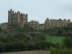
Carr Vale is a small village attached to the New Bolsover model village, Bolsover, Derbyshire, England. It is under Bolsover town. It was begun in the late nineteenth century to house miners of the Bolsover Mining Company.
Excerpt from the Wikipedia article Carr Vale (License: CC BY-SA 3.0, Authors, Images).Carr Vale
Main Street,
Geographical coordinates (GPS) Address Nearby Places Show on map
Geographical coordinates (GPS)
| Latitude | Longitude |
|---|---|
| N 53.224 ° | E -1.303 ° |
Address
Dotti Deli
Main Street
S44 6JF , Carr Vale
England, United Kingdom
Open on Google Maps


