place

Gibside

Country houses in Tyne and WearGrade II listed buildings in Tyne and WearNational Trust properties in Tyne and WearParks and open spaces in Tyne and WearSites of Special Scientific Interest in Tyne and Wear
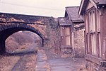
Gibside(JohnDarch)Apr2006

Gibside is an estate in the Derwent Valley in North East England. It is between Rowlands Gill, in Tyne and Wear, and Burnopfield, in County Durham, and a few miles from Newcastle-upon-Tyne. Gibside was previously owned by the Bowes-Lyon family. It is now a National Trust property. Gibside Hall, the main house on the estate, is now a shell, although the property is most famous for its chapel. The stables, walled garden, Column to Liberty and Banqueting House are also intact.

Excerpt from the Wikipedia article Gibside (License: CC BY-SA 3.0, Authors, Images).

Gibside
The Long Walk,

Geographical coordinates (GPS) Address Nearby Places
placeShow on map

Wikipedia: GibsideContinue reading on Wikipedia

Geographical coordinates (GPS)

Latitude Longitude
N 54.9245 ° E -1.7267 °
placeShow on map

Address

Gibside Hall

The Long Walk
NE16 6BG , Lockhaugh
England, United Kingdom
mapOpen on Google Maps

Gibside(JohnDarch)Apr2006
Share experience

Nearby Places

Byermoor

Byermoor is a village near Burnopfield and Sunniside in England. The village has a population of around 100 and contains a school (Sacred Heart) and a church. The village sits on the South side of the A692 on a ridge overlooking the Derwent Valley and the nearby village of Burnopfield. It lies just within the County of Tyne and Wear and is the last village on the old turnpike road to Wolsingham before it reaches the border with County Durham. Byermoor colliery occupied the area to the South of the church prior to closure in 1968, along with four terraces built to house its workforce. Nearest to the A692 were Double Row and New Row and beyond these, Pit Row and Furnace Row. The only one of these houses to survive is the former colliery manager's house that stood at the Eastern end of New Row and was considerably larger than the others. One of the colliery's reservoirs stood alongside this, and the site of the reservoir is now occupied by some small industrial units. The access road to these was originally built as access to Double Row and the colliery itself, while just to the South of this, the road that served New Row is still in place, albeit fenced off and overgrown from a couple of yards beyond the junction with the main road. The remaining housing sits to the North of the church and is made up mainly of semi-detached houses (Ravensworth Crescent, Gibside Crescent, Strathmore Crescent and Bowes Crescent) built by Whickham Urban District Council between 1920 and 1922, as well as a row of four houses constructed around the same time by John Bowes & Partners (at the time the owners of the colliery and the Bowes Railway) to house colliery officials. These are accessed via the lane that originally led to High Marley Hill School, and now continues only a short distance from the end of Bowes Crescent, before becoming a footpath leading to the still extant school building. The school was attended by non-catholic children from the village up until its closure in 1960 due to falling pupil numbers, a fate which also befell the nearby Marley Hill Primary School in 2010. The Collieries and associated coke ovens at Byermoor and Marley Hill were the only significant local sources of employment for the inhabitants of the village, with residents now travelling further afield by car or bus for work. Bus services from Consett and Stanley pass through the village on their way to Newcastle, some via the Team Valley and Gateshead town centre, and some via Whickham and the MetroCentre transport interchange, along with a single bus between Rowlands Gill and the Team Valley early on weekday mornings, returning via the same route in the evening. Although the village had a railway for many years, there was never a passenger service, with the only rail traffic being wagons to and from the colliery and coke ovens and coal traffic from other collieries passing through - either North on its way to the staithes at Jarrow, or unwashed coal from the screens at Marley Hill and Blackburn Fell heading South to the washery at the Hobson Pit about a mile away. This through traffic also ceased not long after the closure of the colliery when the Hobson Pit (which had for some time been the only remaining colliery on the line beyond Byermoor) ceased production later the same year.

Winlaton

Winlaton is a village situated in the Metropolitan Borough of Gateshead, Tyne and Wear. Once in County Durham, it became incorporated into the metropolitan county of Tyne and Wear and Borough of Gateshead in 1974. In 2011 the village was absorbed into the Gateshead MBC ward of Winlaton and High Spen. The population of this ward at the 2011 census was 8,342.Winlaton was once at the centre of the local steel industry. Ambrose Crowley, a Quaker nail-manufacturer, moved in 1691 to Winlaton. He set up furnaces and forges there and on the River Derwent at Winlaton Mill. The river was ideally suitable for tempering steel, as the sword-makers of Shotley Bridge also found. Crowley not only produced high-quality nails, but also iron goods such as pots, hinges, wheel-hubs, hatchets and edged tools. He could also make heavy forgings, such as chains, pumps, cannon carriages and anchors up to four tons in weight. The Crowley works were regarded as the largest manufactory of the kind in Europe. The gates for Buckingham Palace were also forged in Winlaton. It still has one of the oldest forges remaining in existence, built c1690.Winlaton's front street is the village's forefront for shopping, as it has a variety of shops, public houses and takeaways. The Winlaton Centre, a local events venue, was built in 1973, and is host to events such as youth clubs and fitness classes.There is an Anglican church dedicated to St Paul; St Paul's church was built in the 19th–century. There is also a Roman Catholic church, dedicated to St Anne and built in 1962. "Coffee Johnny", a local Blaydon celebrity (1829-1900), is buried at St Paul's church graveyard. He "...would be an outstanding figure in any crowd. Not only was he over six feet six inches and well made (he was a blacksmith at Winlaton), but he was quite a dandy and on special occasions wore a tall white hat."On one of the edges of the village is Winlaton Rugby Club, first founded in 1896, they were reformed in 1962 and currently play at Axwell View Playing Fields where a clubhouse was erected the following year after moving in.