place

Erfurt–Weimar Airport

Airports in ThuringiaBuildings and structures in ThuringiaErfurtPages with disabled graphs
Logo Flughafen Erfurt Weimar

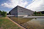
Erfurt–Weimar Airport (German: Flughafen Erfurt–Weimar, formerly Erfurt Airport, IATA: ERF, ICAO: EDDE) serves Erfurt, the capital of the German state of Thuringia, and the nearby city of Weimar, both of which form the largest part of the state's central metropolitan area. The airport is 5 km (3.1 mi) west of Erfurt city center and is mainly used for seasonal charter flights to European leisure destinations.

Excerpt from the Wikipedia article Erfurt–Weimar Airport (License: CC BY-SA 3.0, Authors, Images).

Erfurt–Weimar Airport
Binderslebener Landstraße, Erfurt

Geographical coordinates (GPS) Address Phone number Website External links Nearby Places
placeShow on map

Wikipedia: Erfurt–Weimar AirportContinue reading on Wikipedia

Geographical coordinates (GPS)

Latitude Longitude
N 50.979722222222 ° E 10.958055555556 °
placeShow on map

Address

Flughafen Erfurt-Weimar

Binderslebener Landstraße 100
99092 Erfurt
Thuringia, Germany
mapOpen on Google Maps

Phone number
Flughafen Erfurt GmbH

call+493616562200

Website
flughafen-erfurt-weimar.de

linkVisit website

linkWikiData (Q703794)
linkOpenStreetMap (180789876)

Logo Flughafen Erfurt Weimar
Share experience

Nearby Places

Petersberg Citadel
Petersberg Citadel

Petersberg Citadel (German:Zitadelle Petersberg) in Erfurt, central Germany, is one of the largest and best-preserved town fortresses in Europe. The citadel was built on Petersberg hill, in the north-western part of the old town centre from 1665, when Erfurt was governed by the Electorate of Mainz. It is surrounded by over two kilometres of stone walls and is 36 hectares in size.Erfurt has also been ruled by Sweden, Prussia, Napoleon, the German Empire, the Nazis, and post-World War II Soviet occupying forces, and it was part of the German Democratic Republic (East Germany). All of these regimes used Petersberg Citadel and had an influence on its development. The baroque fortress was in military use until 1963. Since German reunification in 1990, the citadel has undergone significant restoration and it is now open to the public as a historic site. Its maze of underground passageways are also open to visitors and the fortress bakery (1832) is again in working order.The fortress is also known by its French name, Citadelle Petersberg, as French troops were stationed there from 1806 to 1814, when Erfurt was under Napoleonic occupation. Napoleon visited Erfurt several times and the citadel was further developed during his rule, although parts of it were damaged in a battle in 1813.The citadel was built on the site of a medieval Benedictine Monastery and the earliest parts of the complex date from the 12th century.The former lower barracks (German:Untere Kaserne) building is now used to house and administer archives of the Stasi Records Agency.The Cyriaksburg Citadel, is a smaller fortress to the south-west of Erfurt city centre, which dates from 1480. It is now the home of the German Horticulture Museum. During the Napoleonic period a hidden trench connecting the two citadels was built. The remains of this connection can still be seen at the Cyriaksburg Citadel today.

Rieth (Erfurt)
Rieth (Erfurt)

The Rieth is a district in the north of the Thuringian state capital Erfurt, Germany. Rieth is a prefabricated housing estate with 5650 inhabitants (as of 31 December 2012) on an area of 0.72 km², built in 1969. Before the fall of communism, however, considerably more people lived in this district. Neighbouring districts are Hohenwinden-Sulza (industrial area) in the east, Ilversgehofen (Gründerzeit district) in the south, Berliner Platz (prefabricated housing area) in the west, Moskauer Platz (prefabricated housing area) in the northwest, Gispersleben (village) in the north and Roter Berg (prefabricated housing area) in the northeast. The district is situated on the river Gera, its centre is the Platz der Völkerfreundschaft with the shopping centre Vilnius-Passagen. The adjoining district Berliner Platz is de facto regarded by many Erfurters as belonging to the Rieth and is often referred to as the Rieth. The Rieth is connected to the Erfurt city centre by Erfurt Stadtbahn tram lines 1 and 6. The name Rieth frequently appears in Thuringia as a component of place names. These are river floodplains reclaimed in the Middle Ages, which had previously become marshy and had been drained. Today's Rieth district is also located in such a floodplain between the Gera River in the west and the river Schmale Gera in the east. The Rieth was the first GDR housing estate with a complex centre in its centre, but the Johannesplatz was the first prefabricated housing estate to be built in Erfurt in 1965.