River Tay

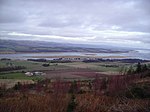
The River Tay (Scottish Gaelic: Tatha, IPA: [ˈt̪ʰa.ə]; probably from the conjectured Brythonic Tausa, possibly meaning 'silent one' or 'strong one' or, simply, 'flowing') is the longest river in Scotland and the seventh-longest in Great Britain. The Tay originates in western Scotland on the slopes of Ben Lui (Scottish Gaelic: Beinn Laoigh), then flows easterly across the Highlands, through Loch Dochart, Loch Iubhair and Loch Tay, then continues east through Strathtay (see Strath), in the centre of Scotland, then southeasterly through Perth, where it becomes tidal, to its mouth at the Firth of Tay, south of Dundee. It is the largest river in the United Kingdom by measured discharge. Its catchment is approximately 2,000 square miles (5,200 square kilometres), the Tweed's is 1,500 sq mi (3,900 km2) and the Spey's is 1,097 sq mi (2,840 km2). The river has given its name to Perth's Tay Street, which runs along its western banks for 830 yards (760 metres).
Excerpt from the Wikipedia article River Tay (License: CC BY-SA 3.0, Authors, Images).River Tay
Cairnie Road,
Geographical coordinates (GPS) Address Nearby Places Show on map
Geographical coordinates (GPS)
| Latitude | Longitude |
|---|---|
| N 56.355 ° | E -3.2983333333333 ° |
Address
Cairnie Road
Cairnie Road
PH2 7TY
Scotland, United Kingdom
Open on Google Maps


