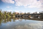
River Mease
AC with 0 elementsRivers of DerbyshireRivers of LeicestershireRivers of StaffordshireSites of Special Scientific Interest in Derbyshire ... and 5 more
Sites of Special Scientific Interest in LeicestershireSites of Special Scientific Interest in StaffordshireTrent catchmentTributaries of the River TrentUse British English from October 2017

The River Mease is a lowland clay river in the Midlands area of England. It flows through the counties of Leicestershire, Derbyshire and Staffordshire and forms the administrative border between these counties for parts of its length. The river and the lower part of one of its tributaries, the Gilwiskaw Brook (pronounced jill-a-whiskey) are both protected as "one of the best examples of an unspoilt meandering lowland river". The river receives protection under European Union law as a Special Area of Conservation (SAC); and protection under UK law as a Site of Special Scientific Interest (SSSI).
Excerpt from the Wikipedia article River Mease (License: CC BY-SA 3.0, Authors, Images).River Mease
Burton Road, Lichfield Edingale
Geographical coordinates (GPS) Address Nearby Places Show on map
Geographical coordinates (GPS)
| Latitude | Longitude |
|---|---|
| N 52.716666666667 ° | E -1.7166666666667 ° |
Address
Burton Road
Burton Road
WS13 8QZ Lichfield, Edingale
England, United Kingdom
Open on Google Maps


