Douglas, British Columbia
British Columbia Coast geography stubsNeighbourhoods in Surrey, British Columbia
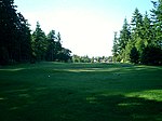
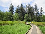
Douglas is a locality in Surrey, British Columbia, Canada, just southeast and outside of the boundary of White Rock, that is the Canadian side of the Peace Arch Border Crossing between British Columbia and Whatcom County, Washington in the United States. Douglas is the location of the Peace Arch Provincial Park portion of the International Peace Arch Park, which it shares with Peace Arch State Park in Blaine, Washington. The community is named for Benjamin Douglas, an early pioneer and railroad surveyor.: 65
Excerpt from the Wikipedia article Douglas, British Columbia (License: CC BY-SA 3.0, Authors).Douglas, British Columbia
176 Street (NEXUS and Bus Lane), Surrey Douglas (South Surrey)
Geographical coordinates (GPS) Address Nearby Places Show on map
Geographical coordinates (GPS)
| Latitude | Longitude |
|---|---|
| N 49.002777777778 ° | E -122.73555555556 ° |
Address
176 Street (NEXUS and Bus Lane) 73
V3Z 1A0 Surrey, Douglas (South Surrey)
British Columbia, Canada
Open on Google Maps


