place

Hawaiʻi Institute of Marine Biology

1912 establishments in HawaiiBiological research institutes in the United StatesEducation in Honolulu County, HawaiiProtected areas of HawaiiResearch institutes established in 1912
Research institutes in HawaiiUniversity of Hawaiʻi
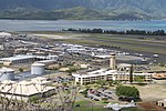
Starr 060228 8947 Aerial photograph of Hawaii

The Hawaiʻi Institute of Marine Biology (HIMB) is a marine biology laboratory located on the state-owned Coconut Island in Kāneʻohe Bay.

Excerpt from the Wikipedia article Hawaiʻi Institute of Marine Biology (License: CC BY-SA 3.0, Authors, Images).

Hawaiʻi Institute of Marine Biology
Lilipuna Road, Kaneohe

Geographical coordinates (GPS) Address Nearby Places
placeShow on map

Wikipedia: Hawaiʻi Institute of Marine BiologyContinue reading on Wikipedia

Geographical coordinates (GPS)

Latitude Longitude
N 21.4327 ° E -157.7877 °
placeShow on map

Address

Lilipuna Road
96744 Kaneohe
Hawaii, United States
mapOpen on Google Maps

Starr 060228 8947 Aerial photograph of Hawaii
Share experience

Nearby Places

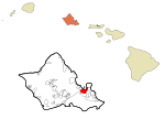
Heʻeia, Hawaii
Heʻeia, Hawaii

Heʻeia (Hawaiian pronunciation: [hɛˈʔɛjə]) is a census-designated place comprising several neighborhoods located in the City & County of Honolulu and the Koʻolaupoko District on the island of Oʻahu north of Kāneʻohe. In Hawaiian the words heʻe ʻia mean "washed away", alluding to a victory achieved by the populace against others from leeward Oʻahu, aided by a tsunami that washed the combatants off the shore.Heʻeia includes Haʻikū Valley and Heʻeia Kea. The population was 5,001 at the 2020 census. Thec area is almost entirely one of homes and apartments. Parts of Heʻeia lie along Kāneʻohe Bay, but public access is non-existent owing to private ownership of the property behind the shore. Notable in the Heʻeia area are: Haʻikū Valley, a former United States Coast Guard radio transmitter site with the Haiku Stairs Site of the former receiving antenna tower for Station HYPO, the naval cryptanalytic station that did so much toward breaking Japanese naval codes in 1941-1942 that resulted in US victory in the Battle of Midway, seen by most historians as the turning point of the Pacific War. The site of their antenna was He'eia, not the site of Station HYPO itself. Station HYPO got its name from the phonetic for the letter "H", because of He'eia where its antenna was sited Heʻeia Fishpond, the largest remaining fishpond on OʻahuHeʻeia Kea is a community and small, undeveloped valley separated from Heʻeia by Heʻeia Marsh and Kealohi Point. Heʻeia Kea Small Boat Harbor, the only public pier and boat ramp on Kāneʻohe Bay, is found here. Several fishponds have been restored in recent years. Although fishponds were developed on most of the islands, the largest concentrations were found in Keʻehi Lagoon, Pearl Harbor, and Kāneʻohe Bay on Oʻahu. The U.S. ZIP code for Heʻeia and Heʻeia Kea is the same as for Kāneʻohe: 96744.

Kāneʻohe Bay
Kāneʻohe Bay

Kāneʻohe Bay, at 45 km2 (17 sq mi), is the largest sheltered body of water in the main Hawaiian Islands. This reef-dominated embayment constitutes a significant scenic and recreational feature along the northeast coast of the Island of Oʻahu. The largest population center on Kāneʻohe Bay is the town of Kāneʻohe. The Bay is approximately 8 mi (13 km) long and 2.7 mi (4.3 km) wide, with a mouth opening of about 4.6 mi (7.4 km) wide and a maximum depth of 40 ft (12 m) in the dredged channel. It has one of the two barrier reefs in the archipelago, the other being the 27 mi (43 km) barrier reef of Molokaʻi island, and also has extensive development of shoaling coral reefs within a large lagoon. Two navigable channels cut across the northern and southern ends of the barrier reef. The deeper, northern channel, located off Kualoa Regional Park, provides entrance from the North Pacific Ocean to a ship channel dredged the length of the lagoon between 1939 and 1945. The lagoon contains extensive patch and fringing reefs and its southern end is partly enclosed by the Mokapu Peninsula. This peninsula is occupied by Marine Corps Base Hawaii. There are five named islands or islets within Kāneʻohe Bay. A sand bar (Ahu o Laka), Kapapa, and Kekepa (Turtleback Rock) are all islets on the barrier reef. Two islands within Kāneʻohe Bay are prominent: Mokoliʻi and Moku o Loʻe (Coconut Island), the largest of the five. Mokoliʻi is a volcanic remnant at the very north end of the Bay, site of former Kualoa Airfield. The community on the northern side is called Waikane, or North Koʻolaupoko. Coconut Island is an isolated volcanic remnant located in the southwest part of the bay. Coconut Island is owned by the state of Hawaiʻi and home to the University of Hawaiʻi, and Pauley-Pagen Laboratory (SOEST). Coconut Island was used for the opening sequence of the television program Gilligan's Island.In August 2010, Pirates of the Caribbean: On Stranger Tides was filmed on the bay.Geologically, Kāneʻohe Bay forms part of a former caldera of the Koʻolau volcano. In prehistory, most of the volcano catalysmically slid into the Pacific Ocean, leaving behind only the Range and the Bay.

Valley of the Temples Memorial Park

Valley of the Temples Memorial Park is a memorial park located on the windward (eastern) side of the Hawaiian island of Oʻahu at the foot of the Koʻolau mountains, near the town of Kāneʻohe. Thousands of Buddhist, Shinto, Protestant and Catholic residents of Hawaiʻi are buried in this memorial park. It was founded by Paul Trousdale in 1963.The park features a 1968 replica of the 11th-century Phoenix Hall of the Byodo-In Buddhist temple complex in Uji, Japan. Inside the main part of the temple is a 9 feet (2.7 m) Amida Buddha statue sitting on a gold lotus leaf.Also on the grounds are large Catholic statues depicting the Passion of Christ, the Virgin Mary, various Catholic saints, crypts and mausoleums of some of the most influential people in Hawaiʻi. Most notable of those interred at the mausoleums of the Valley of the Temples is Walter F. Dillingham, Hawaii entrepreneur and statesman. For a time, former Philippine President Ferdinand E. Marcos was interred at a private mausoleum overlooking the Byodo-In temple.The Byodo-In temple was seen several times in the popular television show Lost as the estate of Sun-Hwa Kwon's father in the Season 1 episode, "House of the Rising Sun," and was later used as the backdrop for Sun and Jin-Soo Kwon's marriage in the Season 5 finale, "The Incident." The temple was also used in season two, episode seven of Magnum P.I. entitled "Tropical Madness" in 1981 and in the season eight episode "Tigers Fan" in 1987. The temple was also used in season two, episode nine of the original Hawaii Five-O series, entitled "The Singapore File," first broadcast 11/19/1969 and in the second part episode "F.O.B" Honolulu".