Ordsall, Nottinghamshire

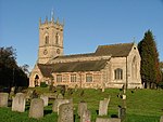
The village of Ordsall is attached to the market town of Retford, Nottinghamshire, England, formally known as East Retford. The Bassetlaw ward of the same name had a population of 14,194 at the 2011 census.All Hallows' Church serves the village and is situated beside the River Idle at the south side of Ordsall, an area sometimes referred to as "Old Ordsall". The River Idle, along with the Great Northern Rail Line, divides Ordsall from Retford. Ordsall is served by Ordsall Primary School, which is on Ordsall Road and from the age of 11 school children have the option of going to one of Retford's two secondary schools, Retford Oaks High School or Elizabethen High School. The football team 'Ordsall Rangers' is the village football team.
Excerpt from the Wikipedia article Ordsall, Nottinghamshire (License: CC BY-SA 3.0, Authors, Images).Ordsall, Nottinghamshire
Wharncliffe Road, Bassetlaw
Geographical coordinates (GPS) Address Nearby Places Show on map
Geographical coordinates (GPS)
| Latitude | Longitude |
|---|---|
| N 53.31 ° | E -0.95 ° |
Address
Wharncliffe Road
Wharncliffe Road
DN22 7RR Bassetlaw
England, United Kingdom
Open on Google Maps


