place

Atterby

Former civil parishes in LincolnshireUse British English from June 2014Villages in LincolnshireWest Lindsey District
Atterby geograph.org.uk 124832

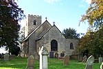
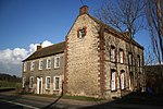
Atterby is a hamlet and former civil parish, now in the parish of Bishop Norton, in the West Lindsey district of Lincolnshire, England. It lies 1 mile (1.6 km) north of Bishop Norton. In 1931 the parish had a population of 82. Atterby was formerly a township in the parish of Bishop-Norton, in 1866 Atterby became a civil parish, on 1 April 1936 the parish was abolished and merged with Bishop Norton.Atterby is now little more than a cluster of buildings at a crossroads; in the 19th century it was larger with 134 inhabitants, a butcher, shop and a carrier.By the early 20th century the Everett family had established a bus service, initially with a horse drawn omnibus and later as pioneers in the use of motorised buses. One of their early vehicles was the "Silver Queen". Everett's buses operated in the local area for many years until quite recently. In 2006 JD Everett is still in the village but as a haulage company. Grade II listed Atterby Mill lies towards the A15 along a private road. It was powered by water from Atterby Beck (which separates the hamlet from Bishop Norton) supplemented by a steam engine. It produced animal feed ground from grain. It was built on the site of a medieval mill. Nearby was the site of an old post windmill, long abandoned.

Excerpt from the Wikipedia article Atterby (License: CC BY-SA 3.0, Authors, Images).

Atterby
Bishop Norton Road, West Lindsey

Geographical coordinates (GPS) Address Nearby Places
placeShow on map

Wikipedia: AtterbyContinue reading on Wikipedia

Geographical coordinates (GPS)

Latitude Longitude
N 53.4247 ° E -0.52384 °
placeShow on map

Address

Bishop Norton Road

Bishop Norton Road
LN8 2BJ West Lindsey
England, United Kingdom
mapOpen on Google Maps

Atterby geograph.org.uk 124832
Share experience

Nearby Places

Snitterby
Snitterby

Snitterby is a village and civil parish in the West Lindsey district of Lincolnshire, England. The population of the civil parish was 215 at the 2001 census, increasing to 245 at the 2011 census. It is situated 14 miles (23 km) north from the city and county town of Lincoln and 8 miles (13 km) south from Brigg. The place name, Snitterby, seems to contain an unrecorded Old English personal name Syntra, + bȳ (Old Norse), a farmstead, a village, so possibly, 'Syntra's farm or settlement'. Eilert Ekwall suggests that this personal name is a derivative of the Old English word snotor, snytre meaning 'wise' The place appears in the Domesday survey of 1086 as Esnetrebi (twice) and Snetrebi.In the late thirteenth century a local resident, Thomas de Snyterby, a lawyer by profession, moved to Ireland, where he became a judge of the Court of Common Pleas (Ireland). He returned to spend his last years in Snitterby but left behind family in Ireland, several of whom also became distinguished judges, including Nicholas de Snyterby, possibly his nephew, in the next generation and Reginald de Snyterby, who died in about 1436. According to the 2001 Census, Snitterby had a population of 215, with 100% of the population being white, and 75% calling themselves Christian.The village is just off the A15 north-east of Caenby Corner, and south-east of Kirton in Lindsey. To the west, along the A15 (Ermine Street), the parish boundary is with Grayingham. To the north, it meets Waddingham, following Snitterby Beck, then eastwards to the New River Ancholme, and then southwards along the River Ancholme, where it meets Owersby, to the east. Near Harlam Hill and Harlam Hill Lock, it meets Bishop Norton, to the south. It passes south of White House Farm, and along Atterby Lane, then crosses Bishop Norton Road, and meets Ermine Street directly to the west. The village has a public house, The Royal Oak, a village hall, and a church, St Nicholas, which is in the Bishop Norton, Waddingham and Snitterby Group of churches. Until 2007 the church clock had to be wound up by hand once a week. A £10,000 grant paid for a new mechanism.

Normanby by Spital
Normanby by Spital

Normanby by Spital is a village and civil parish in the West Lindsey district of Lincolnshire, England. According to the 2001 census it had a population of 318, increasing to 412 at the 2011 census. It is approximately 10 miles (16 km) north from Lincoln, and just off the A15. The village is part of the Owmby Group of parishes.The name Normanby is from the Old English and Old Scandinavian Northman+by, or "Northman village". In the 1086 Domesday Book, the village is given as Normanebi. Normanby by Spital also has a neighbouring village called Owmby-by-Spital. St. Peter's Church dates from the 12th century and is a Grade I listed building. It is redundant and maintained by the Churches Conservation Trust. The church is dedicated to St. Peter and St. Paul. It was extensively renovated in 1890 and it currently seats 100 people. There was a Methodist chapel but now it has been converted into a habitable accommodation. The village facilities include a primary school, a post office, a store, The Bottle and Glass public house, and a school hall. The school hall holds activities such as a youth club and an art club. Normanby by Spital primary school received a 2006 Ofsted inspection rating of Grade 1 (outstanding). A following 2010 inspection rated the school as Grade 2 (good).During the Second World War, a wireless station was in operation along Normanby Cliff Road which was connected to RAF Scampton and was used to transmit messages to Bomber Squadrons over Germany or other enemy territory. Each Bomber Command Group had a similar site and they could be found all over the east of the country. The R/T operators were based at RAF Bawtry, Doncaster. This role continued throughout the "Cold War" period when transmissions were made to the 24/7 airborne V-Bomber squadrons. In later years this role diminished and the station finally closed; the buildings have now been demolished although the site is still fenced off. The Bottle and Glass public house was open for duration of the war, as it was a frequent rest-stop for local airmen. Residents of the village remember the Dambusters raid, hearing the Lancasters going overhead and being concerned that they were "struggling" to keep in the air.