place

Žermanice Reservoir

Buildings and structures in the Moravian-Silesian RegionCieszyn SilesiaCzech building and structure stubsDams completed in 1957Frýdek-Místek District
Moravian-Silesian Region geography stubsReservoirs in the Czech Republic
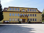
Soběšovice, Žermanická přehrada 02

Žermanice Reservoir (Czech: vodní nádrž Žermanice) is a water reservoir and dam in Lučina in the Moravian-Silesian Region of the Czech Republic. It was built on the Lučina River in 1951–1957 on an area of 2.48 km2 (0.96 sq mi).The reservoir is named after the village of Žermanice. In addition to Lučina on the western shore and Žermanice on the northern shore, there are also the villages of Dolní Domaslavice and Soběšovice on the eastern shore of the reservoir. The reservoir is a popular spot for water sports and other recreational activities. The reservoir is also used to supply water for factories in Ostrava and Paskov.

Excerpt from the Wikipedia article Žermanice Reservoir (License: CC BY-SA 3.0, Authors, Images).

Žermanice Reservoir
okres Frýdek-Místek

Geographical coordinates (GPS) Address Nearby Places
placeShow on map

Wikipedia: Žermanice ReservoirContinue reading on Wikipedia

Geographical coordinates (GPS)

Latitude Longitude
N 49.719444444444 ° E 18.461944444444 °
placeShow on map

Address

ev.33
739 38 okres Frýdek-Místek
Moravia-Silesia, Czechia
mapOpen on Google Maps

Soběšovice, Žermanická přehrada 02
Share experience

Nearby Places

Trans-Olza

Trans-Olza (Polish: Zaolzie, [zaˈɔlʑɛ] ; Czech: Záolží, Záolší; German: Olsa-Gebiet), also known as Trans-Olza Silesia (Polish: Śląsk Zaolziański), is a territory in the Czech Republic, which was disputed between Poland and Czechoslovakia during the Interwar Period. Its name comes from the Olza River. The Trans-Olza region's history begun in 1918, when with the fall of Austro-Hungarian Empire the area was divided between Czechoslovakia and Poland. However, with both sides unsatisfied with the divide, Poland decided to hold elections in the disputed region; which in turn led to its annexation by Czechoslovakia. The area as we know it today was created in 1920, when Cieszyn Silesia was divided between the two countries during the Spa Conference. Trans-Olza forms the eastern part of the Czech portion of Cieszyn Silesia. The division again did not satisfy any side, and persisting conflict over the region led to its annexation by Poland in October 1938, following the Munich Agreement. After the invasion of Poland in 1939, the area became a part of Nazi Germany until 1945. After the war, the 1920 borders were restored. Historically, the largest specified ethnic group inhabiting this area were Poles. Under Austrian rule, Cieszyn Silesia was initially divided into three (Bielitz, Friedek and Teschen), and later into four districts (plus Freistadt). One of them, Frýdek, had a mostly Czech population, the other three were mostly inhabited by Poles. During the 19th century the number of ethnic Germans grew. After declining at the end of the 19th century, at the beginning of the 20th century and later from 1920 to 1938 the Czech population grew significantly to rival the Poles. Another significant ethnic group were the Jews, but almost the entire Jewish population was murdered during World War II by Nazi Germany. In addition to the Polish, Czech and German national orientations there was another group of Silesians, who claimed to be of a distinct national identity. This group enjoyed popular support throughout Cieszyn Silesia, though its strongest supporters were among the Protestants in the eastern part of Cieszyn Silesia (now part of Poland), not in Trans-Olza itself.