place

Mount Craig (North Carolina)

Landmarks in North CarolinaMountains of North CarolinaMountains of Yancey County, North CarolinaPisgah National ForestProtected areas of Yancey County, North Carolina
Southern Sixers
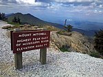
Mount Craig from Mount Mitchell, Oct 2016

Mount Craig, 6,647 feet (2,026 m), is the second highest peak of the Appalachian Mountains and second only to 6,684 feet (2,037 m) Mount Mitchell in eastern North America. It is located in the Black Mountains in Yancey County, North Carolina. The mountain lies about a mile (2 km) north of Mount Mitchell and is within Mount Mitchell State Park and the Pisgah National Forest. Mount Craig was named in honor of Locke Craig, the governor of North Carolina from 1913 to 1917 responsible for establishing Mount Mitchell State Park in 1915 as the state's first, thereby protecting the area from excessive logging.

Excerpt from the Wikipedia article Mount Craig (North Carolina) (License: CC BY-SA 3.0, Authors, Images).

Mount Craig (North Carolina)
Deep Gap Trail,

Geographical coordinates (GPS) Address Nearby Places
placeShow on map

Wikipedia: Mount Craig (North Carolina)Continue reading on Wikipedia

Geographical coordinates (GPS)

Latitude Longitude
N 35.7774 ° E -82.2618 °
placeShow on map

Address

Deep Gap Trail

Deep Gap Trail

North Carolina, United States
mapOpen on Google Maps

Mount Craig from Mount Mitchell, Oct 2016
Share experience

Nearby Places

Mount Mitchell State Park

Mount Mitchell State Park is a 4,789-acre (1,938 ha) North Carolina state park in Yancey County, North Carolina in the United States. Established in 1915 by the state legislature, it became the first state park of North Carolina. By doing so, it also established the North Carolina State Parks System within the same bill. Located at the end of NC 128 off the Blue Ridge Parkway near Burnsville, North Carolina, it includes the peak of Mount Mitchell, the highest peak east of the Mississippi River. From the parking lot, a steep paved path leads visitors to the summit and a raised observation platform with 360 degree views. The grave of Elisha Mitchell, the professor who first noted the mountain's height, is located at the base of the observation platform. The old observation tower was torn down in early October 2006. The trail leading to the summit has been paved, and a new observation platform was constructed and opened to the public in January 2009. An exhibit hall is open seasonally at the summit with information about the mountain's natural, cultural and historical heritage. The park operates a restaurant and a small tent camping sites seasonally. The buildings were built in the 1950s and renovation is planned. Most visitors come between May and November because the only access is the Blue Ridge Parkway but Kevin Bischof, who became superintendent late in 2018, hopes to change that. The park is staffed year-round but most people would not be able to reach the park during the worst weather conditions.The park had 398,000 visitors in 2017.In addition to Mount Mitchell itself, the park encompasses several other peaks which top out at over 6,000 feet (1,800 m) in elevation, including Mount Hallback, Mount Craig (just 52 feet (16 m) shy of Mount Mitchell in elevation and the second highest peak east of the Mississippi River), Big Tom and Balsam Cone. Trails lead to all these summits save Mount Hallback, and their exploration takes visitors away from the crowds on Mount Mitchell but to places similarly spectacular. About 8 miles (13 km) of trails exist within the park in all. Another popular destination reachable by trail within the park is Camp Alice, at an elevation of 5800 ft (1767.84 m) south of the summit of Mount Mitchell. This historic site is the location of a logging and, later, Civilian Conservation Corps tourist camp at the terminus of the old Mount Mitchell toll road. Lower Creek flows across the main trail at this point and it is one of the highest elevation perennial streams in the Appalachians, flowing through the Spruce-Fir forest. Openings here in the forest surrounded by evergreens resemble such openings near treeline in higher mountain ranges. The park also serves as the finish line for The Assault on Mount Mitchell and the midpoint for the Mount Mitchell Challenge ultramarathon.

Andrews Geyser
Andrews Geyser

Andrews Geyser is a man-made fountain in Old Fort, North Carolina in McDowell County. The fountain is named for Colonel Alexander Boyd Andrews, a North Carolina native who was the Vice President of the Southern_Railway_(U.S.) Company and one of the men responsible for the construction of the railroad between Old Fort and Asheville, North Carolina, in the late 19th century. The fountain was constructed in 1885 with a dual purpose: it was a feature of the Round Knob Hotel, and a tribute to the approximately 120 men who died building the railroad through this particularly treacherous stretch of land, that culminates with the crossing of the Eastern Continental Divide through the Swannanoa Tunnel. The fountain was said to be eye-catching for railroad passengers ascending the 7.5 miles of track and six tunnels that peaks at the top of Swannanoa Gap because it could be seen several times along the route. The Round Knob Hotel burned to the ground in 1903, and the fountain fell into disrepair. In 1911, George Fisher Baker, a wealthy New York financier and philanthropist who had been friends with Colonel Andrews, funded its restoration. The Southern Railway Company did not grant continuation of the easement for the fountain at that time, so a new, five-sided basin was constructed about 70 yards across Mill Creek, and the piping and nozzle were moved (to the fountain's current location). The Town of Old Fort was given rights to the basin and the pipe that carries the water, and the fountain was formally named Andrews Geyser. The Town of Old Fort continues to use Andrews Geyser and the surrounding area as a public park. Andrews Geyser underwent extensive restoration again in the 1970s, after the Old Fort High School Senior Class of 1971 cleaned up the area and was rededicated on May 6, 1976. Signs at the park describe Mr. Fisher's role in the early 20th century and the role of Old Fort's private citizens in the 1970s in keeping the fountain running. When in operation, Andrews Geyser shoots water continuously to a height of about 80 feet. Its water supply is drawn from a pond located at the current site of the Inn on Mill Creek, a local Bed & Breakfast. The Inn's property contains the original dam constructed by the railroad in the late 19th century, and the pond formed by the dam with the water of the Long Branch of Mill Creek. A 6-inch-diameter (150 mm) cast iron pipe runs from the dam, through a hidden gate valve, then underground approximately two miles downhill to the fountain. The water comes out a half-inch nozzle pointed skyward, and the 500 feet of elevation difference creates the pressure that drives the fountain. Extended dry condition in the area can limit the ability for the fountain to operate continuously. When the natural water inflow rate to the supply pond falls below the rate at which the fountain draws, the fountain can only be run periodically, at best to match the amount of water inflow over an extended period of time. In 1967, author John Ehle wrote a historical fiction novel called The Road, which is set in the construction of the railroad from Old Fort to Swannanoa, NC in the late 19th century. The novel concludes with the main character (an amalgam of several real people who oversaw construction of the railroad) making a direct reference to the Andrews Geyser: Ay, but I'm going to make this fountain and capture that stream up there and bring it down in a trough or a pipe, I don't know just how, and turn it upward at this very place... and let it go as high as it wants to into the sky... In spite of the name, Andrews Geyser is more accurately a fountain and not a geyser.