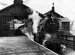
Guisborough
Civil parishes in North YorkshireGuisboroughMarket towns in North YorkshireOpenDomesdayPages including recorded pronunciations ... and 4 more
Places in the Tees ValleyRedcar and ClevelandTowns in North YorkshireUse British English from August 2013

Guisborough ( GHIZ-bər-ə) is a market town and civil parish in the borough of Redcar and Cleveland, North Yorkshire, England. It lies north of the North York Moors National Park. Roseberry Topping, midway between the town and Great Ayton, is a landmark in the national park. At the 2011 census, the civil parish with outlying Upleatham, Dunsdale and Newton under Roseberry had a population of 17,777, of which 16,979 were in the town's built-up area. It was governed by an urban district and rural district in the North Riding of Yorkshire.
Excerpt from the Wikipedia article Guisborough (License: CC BY-SA 3.0, Authors, Images).Guisborough
Westgate,
Geographical coordinates (GPS) Address Phone number Website Nearby Places Show on map
Geographical coordinates (GPS)
| Latitude | Longitude |
|---|---|
| N 54.535 ° | E -1.0563 ° |
Address
Guisborough Library
Westgate 90
TS14 6AP
England, United Kingdom
Open on Google Maps


