place

Welton, Northamptonshire

Civil parishes in NorthamptonshireUse British English from January 2012Villages in NorthamptonshireWest Northamptonshire District
White Horse public house, 5th April 2009

Welton is a village and civil parish in the English county of Northamptonshire. The village is located 2.6 miles (4.2 km) north of the nearest town Daventry. It is 13 miles (21 km) west-north west of Northampton, 9 miles (14 km) south east of Rugby and 78 miles (126 km) north-west of London. The village is 1 mile (1.6 km) off the A361 that runs between Daventry and Crick where the A5 and the M1 junction 18 gives access to the national motorway network north and south. Welton formerly had its own railway station, but today, the nearest railway station is at Long Buckby for the West Midlands Trains services to Birmingham New Street, Northampton and London Euston stations, on the Northampton loop of the West Coast Main Line. For inter-city services (Avanti West Coast), passengers should change at Rugby, the next station westbound. The Village and parish of Welton had in the 2021 census, a population of 596. For the purposes of local government, the village falls within West Northamptonshire.

Excerpt from the Wikipedia article Welton, Northamptonshire (License: CC BY-SA 3.0, Authors, Images).

Welton, Northamptonshire
High Street,

Geographical coordinates (GPS) Address Nearby Places
placeShow on map

Wikipedia: Welton, NorthamptonshireContinue reading on Wikipedia

Geographical coordinates (GPS)

Latitude Longitude
N 52.28929 ° E -1.148929 °
placeShow on map

Address

High Street
NN11 2JW , Welton
England, United Kingdom
mapOpen on Google Maps

White Horse public house, 5th April 2009
Share experience

Nearby Places

Watford Locks
Watford Locks

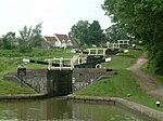
Watford Locks (grid reference SP592688) is a group of seven locks on the Leicester Line of the Grand Union Canal, in Northamptonshire, England, famous for the Watford Gap service area. The locks are formed (looking from the south), of two single locks, a staircase of four, and a final single lock. Together they lift the canal 54 feet 1 inch (16.48 m) to the "Leicester Summit", which it maintains all the way to Foxton Locks. The four staircase locks are equipped with working side ponds which are used to save water. The locks were built to carry narrowboats, and the system was opened in 1814. In the early 20th century there were plans to build an inclined plane similar to that at Foxton as part of a scheme to allow the passage of barges, but the plan was abandoned when the inclined plane at Foxton proved uneconomic.When the Grand Union Canal was formed in 1929, there were further proposals to widen the flight as part of the modernisation going on elsewhere on the Grand Union's network, but these plans did not develop further. The locks are hemmed in by the Roman Watling Street (now the A5 road), the M1 motorway, and the West Coast Main Line railway, which all fit through the narrow Watford Gap, between two hill systems. The locks are usually supervised during the cruising season from Easter to October, with the locks padlocked outside permitted hours. This is done to prevent problems arising from misuse and to ensure that queues are kept to the minimum. Boaters operate the locks themselves under the lock keeper's supervision. On arrival at the top or bottom boaters should report to the lock keeper to register their arrival before attempting to operate the flight. At busy times there can often be a delay of two hours or more but transit of the flight takes approximately 45 minutes; it is made quicker by the fact that the locks are narrow beam and the gates are light.