Charon, Louisiana
AcadianaLouisiana geography stubsUnincorporated communities in LouisianaUnincorporated communities in Vermilion Parish, LouisianaUse mdy dates from July 2023
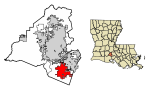
Charon (also spelled "Charogne") is an unincorporated community in Vermilion Parish, Louisiana, United States. It is part of the Abbeville Micropolitan Statistical Area. Charon is located at 30°01′18″N 92°01′23″W (30.021593, -92.023178) at the intersection of Louisiana highways 338 and 339, north of the town of Erath, and consists of the southern part of the LeBlanc Community.
Excerpt from the Wikipedia article Charon, Louisiana (License: CC BY-SA 3.0, Authors).Charon, Louisiana
Highway 339,
Geographical coordinates (GPS) Address Nearby Places Show on map
 Continue reading on Wikipedia
 Geographical coordinates (GPS)
| Latitude | Longitude |
|---|---|
| N 30.021666666667 ° | E -92.023055555556 ° |
Address
Highway 339 8985
70510
Louisiana, United States
Open on Google Maps