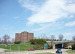
Allegheny County Airport

Allegheny County Airport (IATA: AGC, ICAO: KAGC, FAA LID: AGC) is in West Mifflin, Pennsylvania, United States, 7 miles (11 km) southeast of Pittsburgh. It is the fifth-busiest airport in Pennsylvania following Philadelphia, Pittsburgh, Allentown, and Harrisburg. The airport is owned by the Allegheny County Airport Authority and is the primary FAA-designated reliever airport for Pittsburgh International Airport. Allegheny County Airport was dedicated on September 11, 1931.When it was completed, it was third-largest airport in the country and the only hard-surface airport in the country. It was historically the main entrance to metro Pittsburgh via air from its inception until June 1952, when the Greater Pittsburgh Airport (now Pittsburgh International Airport – KPIT) opened for commercial aviation. Like many historic municipal fields, Allegheny serves small and mid-sized private, corporate and commercial traffic well, but was not built to handle jet airliners. A Boeing 727 owned by Rockwell and two DC-9's however were based on the field for years. One DC-9, owned by Westinghouse Air Brake, operated from the former TWA hangar. Another DC-9 was owned by Richard Scaife. Additionally, political candidates often operate chartered jet airliners into the field. Air Force 2, a Boeing 757, has been on the airport in the 2000s. In May 2017, a Southwest Boeing 737 with 143 passengers en route from Orlando, made a precautionary landing when running low on fuel. The airport is popular among business travelers, being closer to downtown than Pittsburgh International Airport. It is much closer to the densely populated South Hills, Monroeville area and Monongahela Valley. The airport is home to Pittsburgh Institute of Aeronautics (PIA), a large aircraft maintenance school.
Excerpt from the Wikipedia article Allegheny County Airport (License: CC BY-SA 3.0, Authors, Images).Allegheny County Airport
Lebanon Road,
Geographical coordinates (GPS) Address External links Nearby Places Show on map
Geographical coordinates (GPS)
| Latitude | Longitude |
|---|---|
| N 40.354166666667 ° | E -79.93 ° |
Address
Allegheny County Airport
Lebanon Road
15122
Pennsylvania, United States
Open on Google Maps


