place

Dumbarton (district)

1975 establishments in Scotland1996 disestablishments in ScotlandDistricts of ScotlandDumbartonHelensburgh
Politics of Argyll and ButePolitics of West DunbartonshireStates and territories disestablished in 1996States and territories established in 1975StrathclydeVale of Leven
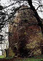
Crosslet House geograph.org.uk 2772176

Dumbarton (Scottish Gaelic: Dùn Breatainn) was, from 1975 to 1996, one of nineteen local government districts in the Strathclyde region of Scotland, covering the town of Dumbarton and surrounding areas to the north-west of Glasgow.

Excerpt from the Wikipedia article Dumbarton (district) (License: CC BY-SA 3.0, Authors, Images).

Geographical coordinates (GPS)

Latitude Longitude
N 56.01 ° E -4.63 °
placeShow on map

Address

Auchendennan Muir


G83 8RB
Scotland, United Kingdom
mapOpen on Google Maps

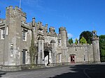
Crosslet House geograph.org.uk 2772176
Share experience

Nearby Places

River Leven, Dunbartonshire

The River Leven (Uisge Leamhna in Gaelic) is a stretch of water in West Dunbartonshire, Scotland, flowing from Loch Lomond in the North to the River Clyde in the South. The river is about 6 miles (10 kilometres) long. It is very popular with salmon and sea trout anglers, trying to catch one of these migratory fish going up to Loch Lomond. The Vale of Leven is a collection of communities in the northern part of the river, whilst the town of Dumbarton sits at the southern end. Dumbarton Castle sits at the confluence of the river with the Clyde. The Leven is a relatively short river but is widely claimed to be the second fastest flowing river in Scotland, after the River Spey. Possibly because of this, or possibly because it passes through a built-up area, it has a reputation as a dangerous river with many drownings over the years. The Linnbrane Hole in Alexandria is reputed to be the most dangerous spot. The river is crossed by nine bridges and two weirs. There is a path for pedestrians and cyclists near the river, which connects with a cycle path to Glasgow. It follows the river very closely from Balloch to Renton, less closely from Renton to Dumbarton. The river includes two large meander bends, at Cordale and Dalquhurn. In the past the river was used to get steamers into Loch Lomond, although they sometimes did not find it an easy journey and could have difficulty getting past the bridges. Nowadays the river is considered to be not navigable. The height of the river can vary, sometimes being a good deal higher in winter than summer.