Puckeys Estate Reserve
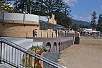
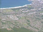
Puckey's Estate Reserve is a coastal nature reserve in North Wollongong, New South Wales, Australia. It is mainly she-oak forest, but also has sand dune and wetland areas, including areas along Para Creek. It is located in the suburb of Fairy Meadow and is bounded by Fairy Meadow Beach to the east, Squires Way to the west, Elliotts Road to the north and Fairy Lagoon to the south. Puckey's Estate was traditionally used by the Wadi Wadi people, the Aboriginal tribe in Wollongong. It was once owned by a Mr Courtney Puckey for use as an experimental saltworks and still contains the historic site of Puckey's graduation tower and house, a jetty site he built and plaques on aboriginal and European historic uses for the area. The area is used by many locals and visitors as a recreation area. It is also used for education purposes; schools and community groups work there, and on some days including Australia Day, runs are held through the reserve, along the main track. The south end of the main track, running through the reserve, comes to a wooden boardwalk, from which Fairy Lagoon, Mount Keira, Stuart Park and parts of North Wollongong can be viewed. Cyclists generally take the paved Squires Way route. The reserve is also locally famous for its bird-watching opportunities, having over 120 species recorded. It is important to local flora and fauna, but is also the scourge (dealt with by local volunteer groups) of bitou bush, Lantana and other imported weeds such as prickly pear. Puckey's is managed as a separate section (annexe) of the Wollongong Botanic Garden.
Excerpt from the Wikipedia article Puckeys Estate Reserve (License: CC BY-SA 3.0, Authors).Puckeys Estate Reserve
Squires Way Shared Path, Wollongong City Council North Wollongong
Geographical coordinates (GPS) Address Nearby Places Show on map
Geographical coordinates (GPS)
| Latitude | Longitude |
|---|---|
| N -34.405555555556 ° | E 150.90111111111 ° |
Address
Squires Way Shared Path
Squires Way Shared Path
2500 Wollongong City Council, North Wollongong
New South Wales, Australia
Open on Google Maps


