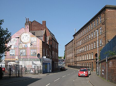
Mabgate

Mabgate is an inner city area of Leeds, West Yorkshire, England and the name of one of its streets. In Leeds City Council's Mabgate Development Framework (2007), "the area is bounded to the west by North Street; to the east by Macaulay Street; to the north by Mushroom Street and to the south by the New York Road". Mabgate, the street, continues for a short distance on the south side of New York Road (A64(M)). The area is in the Burmantofts and Richmond Hill ward of Leeds City Council. The area to the west of Regent Street is within the city centre boundary.The name comes from 'Mab', meaning a prostitute (16th to 19th century) and 'gate' meaning a street (common in Yorkshire street names).
Excerpt from the Wikipedia article Mabgate (License: CC BY-SA 3.0, Authors, Images).Mabgate
Mabgate, Leeds Lovell Park
Geographical coordinates (GPS) Address Nearby Places Show on map
Geographical coordinates (GPS)
| Latitude | Longitude |
|---|---|
| N 53.802 ° | E -1.531 ° |
Address
Mabgate
LS9 7DR Leeds, Lovell Park
England, United Kingdom
Open on Google Maps


