place

Muskingum River

Muskingum RiverRivers of Coshocton County, OhioRivers of Morgan County, OhioRivers of Muskingum County, OhioRivers of Ohio
Rivers of Washington County, OhioTributaries of the Ohio River
Muskingum River Marietta

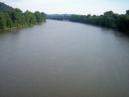
The Muskingum River ( mə-SKING-(g)əm; Shawnee: Wakatamothiipi) is a tributary of the Ohio River, approximately 111 miles (179 km) long, in southeastern Ohio in the United States. An important commercial route in the 19th century, it flows generally southward through the eastern hill country of Ohio. Via the Ohio, it is part of the Mississippi River watershed. The river is navigable for much of its length through a series of locks and dams.

Excerpt from the Wikipedia article Muskingum River (License: CC BY-SA 3.0, Authors, Images).

Muskingum River
Fort Street,

Geographical coordinates (GPS) Address Nearby Places
placeShow on map

Wikipedia: Muskingum RiverContinue reading on Wikipedia

Geographical coordinates (GPS)

Latitude Longitude
N 39.409166666667 ° E -81.456111111111 °
placeShow on map

Address

Fort Harmar Monument

Fort Street
45750 , Harmar
Ohio, United States
mapOpen on Google Maps

Muskingum River Marietta
Share experience

Nearby Places

Fort Harmar
Fort Harmar

Fort Harmar was an early United States frontier military fort, built in pentagonal shape during 1785 at the confluence of the Ohio and Muskingum rivers, on the west side of the mouth of the Muskingum River. It was built under the orders of Colonel Josiah Harmar, then commander of the United States Army, and took his name. The fort was intended for the protection of Indians, i.e., to prevent pioneer squatters from settling in the land to the northwest of the Ohio River. "The position was judiciously chosen, as it commanded not only the mouth of the Muskingum, but swept the waters of the Ohio, from a curve in the river for a considerable distance both above and below the fort." It was the first frontier fort built in Ohio Country.It is notable as the site for the 1789 Treaty of Fort Harmar between the United States and several Native American tribes. The presence of Fort Harmar was influential in the founding of Marietta, Ohio in 1788 to the east across the Muskingum. During the one-year anniversary celebration of the founding of Marietta, the physician Solomon Drowne said: But to whom is this settlement more indebted than to the generous chieftain [Josiah Harmar] and other worthy officers of yonder fortress, distinguished by the name of Harmer [Fort Harmar]. With what cheerfulness and cordiality have ye ever entered into every measure promotive of the company's interest. Important is the station ye fill in every respect, and not least in this, that you seem reserved to exhibit to mankind a specimen of that military splendor, which ornamented the arms of America, and would do honor to the troops of any potentate on earth. The fort was abandoned in 1790 and demolished in summer, 1791, as the area had been redeveloped for other uses, and Marietta expanded to the west side of the river. The exact location of the fort cannot be determined as the Ohio River has been widened by damming, and is believed to be underwater near the mouth of the Muskingum. This area of Marietta is still referred to as Harmar, and the neighborhood has been listed on the National Register of Historic Places as the Harmar Historic District.

First Unitarian Church of Marietta

The First Unitarian Church of Marietta is a historic Unitarian Universalist church in the city of Marietta, Ohio, United States. Founded in 1869, it uses a building constructed in 1858 for one of its two predecessor churches; this building's high-quality architecture has led to its designation as a historic site. In January 1830, Nahum Ward published an advertisement in the Marietta Intelligencer seeking to find other friends of liberal religion, and the resulting group organized as a Unitarian church in the following month.: 395  Members laid the cornerstone of their building in July 1855, and by the time of the building's dedication in June 1857, the congregation had paid approximately $25,000 for lot, materials, furnishings, and labor. The original form of the congregation ceased to exist in May 1869 at its merger with the city's Universalist church, which itself had been founded in 1817 but suffered severe damage to its property in an 1860 flood. The combined church took the name of "First Universalist Church of Marietta".: 396 Built of brick on a stone foundation and featuring additional elements of stone, the First Unitarian Church is a Gothic Revival building. Pilasters divide the facade into three bay, with the doorway in the center, and the side is divided into five. The left bay of the facade, from the perspective of a viewer on the street, is occupied by the base of a square tower nearly twice the height of the rest of the building; while shorter windows in the tower and facade sit below similar second-story windows, and the side windows occupy the height of both stories, tall third-story windows are set near the top of the tower, and the pilasters on all four corners of the tower, similar to those on the rest of the building, are crowned with pointed pinnacles. The building's general shape is that of a front-gable rectangle, with small-size crenellations atop the edges, and the Gothic Revival style is typified by the ogive windows and doorways in the facade and side. Constructed under the direction of architect John M. Slocomb, the building is one of the region's earliest extant Gothic Revival churches. Both stonework and brickwork were completed by local craftsmen, the bricks being made from clay extracted from Sacra Via, the ceremonial walls built by the Mound Builders near the edge of the Muskingum River.In October 1973, the church was listed on the National Register of Historic Places, qualifying both because of its architecture and its close connection to Nahum Ward, who was deemed a significant resident of nineteenth-century Marietta. It was the last of four Marietta locations to be listed on the Register in 1973, following the Mound Cemetery Mound in February and the Wilcox-Mills House and Erwin Hall at Marietta College in April. It is also a part of the Marietta Historic District, listed on the Register in 1974, which embraces more than two thousand buildings across 900 acres (360 ha) of the city.
Marietta Historic District (Marietta, Ohio)

The Marietta Historic District is a historic district in Marietta, Ohio, United States that is listed on the National Register of Historic Places. Among the buildings in the district are ones dating back to 1788, the year in which Marietta was founded as the first white settlement in what is now Ohio. Among its most significant buildings are the Rufus Putnam House and the Ohio Company Land Office, which are also separately listed on the Register.When the district was added to the Register in 1974, it encompassed an area roughly bounded by the Muskingum and Ohio Rivers and Warren, Third, Fifth, and Sixth Streets. In 2001, some of its original boundaries were slightly reduced, but it was also expanded greatly to include an area roughly bounded by Marion, Montgomery, Ohio, Greene, Butler, and Second through Ninth Streets, and the Ohio and Muskingum Rivers. The resulting district encompasses over 900 acres (360 ha) and includes over two thousand contributing properties.The National Register includes properties and districts that are considered historic under any of four criteria: Association with significant events in American history Association with significant historical individuals Well-preserved and historically significant architecture Possibility of yielding archaeological evidenceWhile most properties and districts on the Register qualify under one or two of the criteria, the Marietta Historic District qualifies under all four.