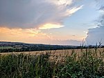
Langley Park, County Durham

Langley Park is a village in County Durham, England. The historic city of Durham lies 4 miles (6.4 km) to the east, and the larger city (and regional capital) of Newcastle upon Tyne is 15 miles (24 km) to the north. The village has a wide variety of shops and amenities and is also home to Diggerland, where children of all ages can take control of a variety of heavy machinery and take rides over the former colliery ground on bulldozers and Landrovers. The village has a primary school which includes nursery, reception, infant and junior classes. The Lanchester Valley Railway Path runs along the northern edge of Langley Park on the site of the disused Consett Iron Works railway line. It is designated as National Route 14 on the Sustrans National Cycle Network which runs from Haswell, via Durham City, to Consett. Langley Park has grown steadily in recent years and has benefited from the influx of new residents, who are attracted to the village by the construction of several housing developments. Current housing projects are underway on the site of the former Kings Picture house and Hilltop View and plans are in hand to construct houses on the current site of Anderson & Young coachworks. The River Browney, which flows to the north of the village, has recovered from the effects of contamination caused by a century of local industry and is fished regularly both by anglers and by otters who have made a welcome return to the river in recent years. There are Commonwealth War Graves in the cemetery of the Anglican church, All Saints in Langley Park, which is also the only grave of the unknown soldier outside London.
Excerpt from the Wikipedia article Langley Park, County Durham (License: CC BY-SA 3.0, Authors, Images).Langley Park, County Durham
Front Street,
Geographical coordinates (GPS) Address Website Nearby Places Show on map
Geographical coordinates (GPS)
| Latitude | Longitude |
|---|---|
| N 54.799 ° | E -1.67 ° |
Address
Saint Andrew's Methodist Church
Front Street
DH7 9XB
England, United Kingdom
Open on Google Maps


