place

Stowe Mountain Resort

American International GroupBuildings and structures in Stowe, VermontSki areas and resorts in VermontStowe, VermontTourist attractions in Lamoille County, Vermont
Vail Resorts

Stowe Mountain Resort is a ski resort in the northeastern United States, near the town of Stowe in northern Vermont, comprising two separate mountains: Mount Mansfield and Spruce Peak. The lift-served vertical drop of Mount Mansfield is 2,360 feet (719 m), the fifth largest in New England and the fourth largest in Vermont.

Excerpt from the Wikipedia article Stowe Mountain Resort (License: CC BY-SA 3.0, Authors).

Stowe Mountain Resort
Crossover,

Geographical coordinates (GPS) Address Nearby Places
placeShow on map

Wikipedia: Stowe Mountain ResortContinue reading on Wikipedia

Geographical coordinates (GPS)

Latitude Longitude
N 44.531944444444 ° E -72.7875 °
placeShow on map

Address

Crossover

Vermont, United States
mapOpen on Google Maps

Share experience

Nearby Places

Smugglers Notch
Smugglers Notch

Smugglers Notch (alternatively Smugglers' or Smuggler's) is a mountain pass in Lamoille County, Vermont. The notch separates Mount Mansfield, the highest peak of the Green Mountains, from Spruce Peak and the Sterling Range. Most of the notch is in Mount Mansfield State Forest. North of the height of land, Smugglers Notch is drained by the Brewster River, which drains into the Lamoille River, and into Lake Champlain. To the south, the notch is drained by the West Branch Waterbury River, then into the Little River, the Winooski River, and into Lake Champlain. Smugglers' Notch derives its name from activities precipitated by a request of President Thomas Jefferson to prevent American involvement in the Napoleonic Wars. The Embargo Act of 1807 forbade American trade with Great Britain and Canada. But proximity to Montreal made it a convenient trading partner, and the Act caused great hardship for Vermonters, many of whom continued the illegal trade with Canada, carrying goods and herding livestock through the Notch. Fugitive slaves also used the Notch as an escape route to Canada. The route was improved to accommodate automobile traffic in 1922 thus providing a route for liquor to be brought in from Canada during the Prohibition years. Smugglers' Notch State Park was created near the Notch by the depression-era Civilian Conservation Corps. In 2003 the park was relocated, allowing for a larger campground and new, modern facilities incorporating alternative energy. In order to preserve the work of these pioneering conservationists, all original structures created by the CCC were painstakingly relocated to the new site. The Long Trail, a 272-mile (438-km) hiking trail running the length of Vermont, traverses Smugglers' Notch. The trail down from the summit of Mt. Mansfield to the east reaches the road south of the height of the pass, and resumes across Route 108 at the Barnes Camp Visitor Center, climbing east to the summit of Madonna Peak. Smugglers' Notch Resort is located on the northeast side of the pass on the northern side of the Sterling Range with developments on Spruce Peak (referred to as Sterling Mountain by the resort), Madonna Peak (referred to as Madonna Mountain by the resort), and the lower portion of Morse Mountain. The resort takes its name from the pass. Stowe Mountain Resort straddles the southern end of the pass, with developments on both Mt. Mansfield and Spruce Peak.
Mount Mansfield
Mount Mansfield

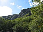
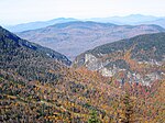
Mount Mansfield is the highest mountain in Vermont with a summit that peaks at 4,393 feet (1,339 m) above sea level. The summit is located within the town of Underhill in Chittenden County; the ridgeline, including some secondary peaks, extends into the town of Stowe in Lamoille County, and the mountain's flanks also reach into the town of Cambridge.When viewed from the east or west, this mountain has the appearance of a (quite elongated) human profile, with distinct forehead, nose, lips, chin, and Adam's apple. These features are most distinct when viewed from the east; unlike most human faces, the chin is the highest point.Mount Mansfield is one of three spots in Vermont where true alpine tundra survives from the Ice Ages. A few acres exist on Camel's Hump and Mount Abraham nearby and to the south, but Mount Mansfield's summit still holds about 200 acres (81 ha). In 1980, the Mount Mansfield Natural Area was designated as a National Natural Landmark by the National Park Service.Located in Mount Mansfield State Forest, the mountain is used for various recreational and commercial purposes. "The Nose" is home to transmitter towers for a number of regional radio and TV stations. There are many hiking trails, including the Long Trail, which traverses the main ridgeline. In addition, the east flank of the mountain is used by the Stowe Mountain Resort for winter skiing. A popular tourist activity is to take the 4.5-mile (7.2 km) toll road (a steep, mostly unpaved road with several hairpin turns) from the Stowe Base Lodge to "The Nose" and then hike along the ridge to "The Chin."