place

Lake Bella Vista (Michigan)

AC with 0 elementsLakes of Kent County, MichiganLakes of MichiganWest Michigan geography stubs

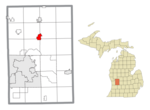
Lake Bella Vista is in northwest Cannon Township, Kent County in the U.S. state of Michigan. The lake was originally known as "Grass Lake" and once lay in the center of a marsh surrounded by pastureland as well as apple and cherry orchards. Grass Lake was one of the so-called "triplet lakes" lying along M-44. Its sister lakes to the east are Silver Lake and Bostwick Lake. Developed by the Velting family contractors in the mid-1970s, Grass Lake was expanded and a large dike was added to the western edge to raise the water level. Residential and commercial development was soon constructed and in the early 21st century, a lakeside suburban sub-division also called "Lake Bella Vista" functions very much as a community. Lake Bella Vista is bordered by M-44, (Belding Road) on the south, 9 Mile Road on the North, Blakely Road on the West, and Myers Lake Avenue on the East. To the south are the Lockhart family orchards and the beginning of the Stout Creek watershed which cuts through forest-concealed glacial dunes bordering the Woodbrook area.In the spring of 2013, the Rockford High School Rowing Team used the lake for team practices during a flood which made their boathouse, on the Grand River, inaccessible.The residents of Lake Bella Vista are all in Rockford public schools, with elementary students attending Crestwood Elementary and middle school students attending East Rockford Middle School.

Excerpt from the Wikipedia article Lake Bella Vista (Michigan) (License: CC BY-SA 3.0, Authors).

Lake Bella Vista (Michigan)
Decosta Drive,

Geographical coordinates (GPS) Address Nearby Places
placeShow on map

Wikipedia: Lake Bella Vista (Michigan)Continue reading on Wikipedia

Geographical coordinates (GPS)

Latitude Longitude
N 43.09001 ° E -85.5162 °
placeShow on map

Address

Decosta Drive

Decosta Drive
49341
Michigan, United States
mapOpen on Google Maps

Share experience

Nearby Places

Stout Creek

Stout Creek is a stream located in central Cannon Township of Kent County in the U.S. state of Michigan.This water source is named for the frontier family of Andrew Stout, 1850s founder of the Kent County lumber town of Plainfield at the Rogue and Grand Rivers intersection. Stout Creek sources deep in an oak, maple and white pine woodland and winds its way Southwesterly through ancient dunes and spring beds. The waterway is joined by Schutte's Creek before eventually emptying into Trout Creek, (sometimes known as "Kaiser's Creek"), which in turn joins Bear Creek on its southwesterly flow to the Grand River. This medium-sized brook is said to have once served as a water source for a small Native American settlement reported to have nestled upon a nearby sandy slope. In the late 19th century and early 20th century Stout Creek bordered potato fields which were later turned back to marshland. In addition it served to water the cattle and horses of a nearby hamlet inhabited by Seventh-day Adventists. The black-mud springbeds and loamish hillsides of the Stout Creek Valley are host to a number of woodland plants enjoyed by nature lovers. Among this flora are found the following; marsh marigold, skunk cabbage, scour grass, partridge berry, wintergreen, elderberry, wild ginseng, wild ginger, bloodroot, blue violet, white violet, yellow violet, hypatica, Turk's cap, columbine, christmas fern, fiddle head fern, snowberry, sassafras, thorn apple and a host of others. The Stout Creek valley holds the charm of several legends known to locals. There is the story of the nearby Pow Wow Hill, where natives once gathered around a hilltop fire pit. The marshland is said to hide a quicksand pit to which an early 20th-century farmer once lost a horse. Nearby dunes once concealed a liquor still in the age of prohibition and, in the early 1970s, locals enjoyed combing a sandpit said to hold a treasure of arrowheads. Stout Creek Valley can be accessed by Seven Mile Road NE, and has become part of a wooded bedroom community serving Northeast Grand Rapids.