place

Diest

DiestMunicipalities of Flemish BrabantPages including recorded pronunciationsPages with Dutch IPA
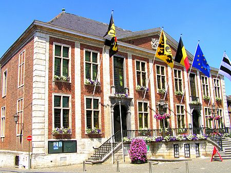
Stadhuis Diest
Stadhuis Diest

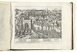
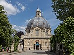
Diest (Dutch pronunciation: [ˈdist] ) is a city and municipality located in the Belgian province of Flemish Brabant. Situated in the northeast of the Hageland region, Diest neighbours the provinces of Antwerp to its North, and Limburg to the East and is situated around 60 km from Brussels. The municipality comprises the city of Diest proper and the towns of Deurne, Kaggevinne, Molenstede, Schaffen and Webbekom. As of January 1, 2006, Diest had a total population of 22,845. The total area is 58.20 km² which gives a population density of 393 inhabitants per km².

Excerpt from the Wikipedia article Diest (License: CC BY-SA 3.0, Authors, Images).

Diest
Egide Alenusstraat,

Geographical coordinates (GPS) Address Nearby Places
placeShow on map

Wikipedia: DiestContinue reading on Wikipedia

Geographical coordinates (GPS)

Latitude Longitude
N 50.983333333333 ° E 5.05 °
placeShow on map

Address

Egide Alenusstraat 13-15
3290 (Diest)
Flemish Brabant, Belgium
mapOpen on Google Maps

Stadhuis Diest
Stadhuis Diest
Share experience

Nearby Places

N2 road (Belgium)

The N2 road in Belgium is a road connecting Brussels and Maastricht passing Leuven, Diest and Hasselt. It starts in Brussels at the Madou crossroad on the small ring, heading northeast as the Chaussée de Louvain/Leuvensesteenweg, which crosses the municipalities of Saint-Josse-ten-Noode, City of Brussels, Schaerbeek, Evere and Woluwe-Saint-Lambert in Brussels, and then enter Flanders via the municipality of Zaventem, Flemish Brabant. When the road enters the municipality of Herent it is named Brusselsesteenweg up to Leuven. When it leaves Leuven, the road is named Diestsesteenweg as it leads to Diest. It is then named successively Staatsbaan, Leuvensesteenweg, Diestsesteenweg, Staatsbaan, Leuvensesteenweg and Eduard Robeynslaan. When leaving Diest and entering Halen, the road enters the province of Limburg. At this point, the road (named Halensebaan) crosses the European route E314. The subsequent names of the road are: Staatsbaan, Grote Baan, Diestsesteenweg, Steenweg, Diestersteenweg, Kuringersteenweg. Just before entering Hasselt, the road crosses the European route E313. When leaving Hasselt, it is named Diepenbekerweg, then Steenweg, Kapelstraat, Wijkstraat, Grendelbaan, Tipstraat, Beverststraat, Holt, Hasseltstestraat, Brugstraat, Maastrichterstraat, Bilzerbaan and Tweede Carabinierslaan. It then enters the Netherlands. The road crosses in total 19 municipalities. 5 in the Brussels-capital Region, 8 in the province of Flemish Brabant and 6 in the province of Limburg. Full municipality list is available below, main municipalities are in bold.