place

Walmley

Areas of Birmingham, West MidlandsEngvarB from February 2018Sutton Coldfield
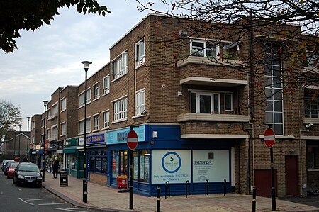
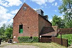
Walmley Court
Walmley Court

Walmley is a suburban village situated in the civil parish of Sutton Coldfield, West Midlands. It lies within the City of Birmingham on its northeastern outer fringe, where it forms part of the Sutton Walmley and Minworth electoral ward. It is in southern Sutton Coldfield, close to Minworth, Wylde Green, Pype Hayes and south of Thimble End. It is approximately 7 miles (11.3 km) northeast of Birmingham City Centre. It is the main focus of the Sutton New Hall Birmingham City Council ward.

Excerpt from the Wikipedia article Walmley (License: CC BY-SA 3.0, Authors, Images).

Walmley
Walmley Close, Birmingham

Geographical coordinates (GPS) Address Nearby Places
placeShow on map

Wikipedia: WalmleyContinue reading on Wikipedia

Geographical coordinates (GPS)

Latitude Longitude
N 52.540464 ° E -1.800289 °
placeShow on map

Address

Walmley War Memorial

Walmley Close
B76 1NQ Birmingham
England, United Kingdom
mapOpen on Google Maps

Walmley Court
Walmley Court
Share experience

Nearby Places

New Hall Manor Estate

The New Hall Manor Estate is the younger of the two major housing estates named after New Hall Manor in Walmley, West Midlands. The other estate is the New Hall Estate. It was built around 2000 and half was built by one company and the other half by another. This caused one half to be called "The Grange" by locals however this is an unofficial name. It was officially named The Avenue. This half is considered the most affluent part of the estate. The houses are larger than the others and house prices can reach £750,000. Most of the estate is built along Elm Road which then has smaller roads trailing off it. Although most of the houses are designed to a style of contemporary, countryside houses, the space between each house is narrow to meet with requirements. One design of a house can only be used 3 times on the whole estate so repeated designs are infrequent. The back of the estate is New Hall Valley Country Park (phase 1) and has recently had an addition of playing fields. A walking trail has been added which passes through a small wooded area to Wylde Green Road. The land on which the estate is situated on used to be farmed as a part of New Hall Farm and New Skipton Farm. Some of the trees have been retained and gates which were once used to separate fields are now used in driveways as ornamental features. The barn and farmhouse of New Skipton Farm were saved from demolition and have been converted into houses, New Hall Farm was Demolished in the 1980s to make way for the New Hall Estate.

New Hall Manor
New Hall Manor

New Hall Manor is a medieval manor house, now used as a hotel, in Sutton Coldfield, West Midlands, England. It is claimed to be one of the oldest inhabited moated houses in Britain, dating from the 13th century when the Earl of Warwick built a hunting lodge on the site. The first reference to the site as a manor is from 1435 when by the homage in a court baron at Sutton after Sir Richard Stanhope's death, when he held it of the Earl of Warwick. The core of the present building, including the great hall, dates from the 16th century when the Gibbons family (relatives of Bishop Vesey) were in residence. Thomas Gibbons is said to have bought New Hall in 1552. Later owners included the Sacheverells, who received it from Thomas and Edward Giddons, and the Chadwicks, who were bequeathed it from George Sacheverell. In 1739, the Sacheverells mortgaged the New Hall estate to Francis Horton of Wolverhampton. The buildings served briefly as a school from 1885; Lt. Col. Wilkinson restored the Hall to residential use in 1903. In 1923 it was acquired by Alfred Owen of Rubery Owen and remained the Owen family home until the 1970s. It was converted to a hotel in 1988 by Ian Hannah and Ken Arkley, of Thistle Hotels. It is now owned and operated by Hand Picked Hotels. The house gives its name to Sutton New Hall ward, New Hall Valley and the New Hall Valley Country Park therein, and also the New Hall Estate and New Hall Manor Estate, which was constructed on New Hall Farm, both residential developments. Plants Brook used to drive New Hall Mill before being channelled away from the mill. The building is Grade I listed, with other Grade II structures. Bon Jovi's music video for "I'll Sleep When I'm Dead" was filmed at New Hall Manor in 1993. The exteriors of the building were additionally briefly used during the third season of TV show Killing Eve in 2020

New Hall Valley Country Park

New Hall Valley Country Park is a country park located in New Hall Valley between Walmley, Wylde Green and Pype Hayes in the Sutton Coldfield area of north Birmingham. It is the first new country park in the UK for over a decade. The park is split into "phases". It was created in 2005 by Birmingham City Council with funding raised from the release of land for the New Hall Manor Estate development and formally opened on August 29, 2005. The park covers over 160 acres (0.6 km2) of designated green belt land to the south east of Sutton Park, including ancient woodland, historic wetland grazing meadows, former farmland, and part of Plants Brook. It borders on a number of privately owned listed buildings including the 17th century Grade II listed New Hall Mill, a corn mill. This is one of only two working water mills surviving in Birmingham water mills in Birmingham, with the other being Sarehole Mill in Hall Green. It has been restored and is open to the public on certain days or by prior arrangement. Bishop Walsh Catholic School borders the land, with the school's playing fields running adjacent for nearly 1.5 miles. The park also includes a network of cycle routes and footpaths (52.550930°N 1.806816°W / 52.550930; -1.806816, a plant nursery, a nature conservation site and two play areas for children. The park is crossed by Wylde Green Road, which links Walmley and Wylde Green at either end. This road was crossed by a ford until around 1967. Coopers Wood, the ancient woodland in the park, is under threat of being destroyed due to concerns that its trees, which are Crack Willow, may fall onto people using the paths that have been driven through them.You can access the park: By foot via Coleshill road at the bottom of Reddicap Hill Road, via the cycle path By foot or via the carpark on Wylde Green Road (next to Bishop Walsh School) By foot under the railway bridges on Ebrook Road and East View Road By foot from Fledburgh Drive on the New Hall Estate By foot down the cycle path from New Hall Manor Estate By foot from the northern end of Pype Hayes Park via the Plants Brook From Plants Brook Local Nature Reserve by crossing Eachelhurst Road heading towards Penns Lane

Pype Hayes Park

Pype Hayes Park is one of the larger parks in Birmingham, England. The park is in Erdington Constituency and straddles the boundary between Pype Hayes and Erdington (now Tyburn ward. It covers B72 and B24. The northern boundary of the park is the traditional boundary between Erdington and Sutton Coldfield. Pype Hayes Park reaches from the corner where Eachelhurst Road joins Chester Road to a point close to Park Close off Chester Road and in places borders Pitts Farm estate. It also leads to Berwood Farm Road and Welwyndale Road. The main park entrance is on Chester Road and by that entrance is the lodge where the head gardener lives, like Pype Hayes Hall this is a grade II listed building. To the left of the main drive to Pype Hayes Hall is a car parking area and further on towards Pype Hayes Hall is a children’s play area with swings and other attractions. Returning to the main drive one can get to the front entrance of Pype Hayes Hall and round there are gardens. The older gardens have a traditional layout with many fairly straight flower beds and dwarf yew hedges. To the north of the traditional garden is a modern garden planted for the millennium. A fountain that was the centrepiece of this garden was vandalised and has been left unrepaired for several years. To the west of the gardens is a fish pond which is also a duck pond with a duck island, many species of water birds can be found there, notably Mallard ducks, Canada geese and frequently a pair of resident mute swan. By the corner where Chester Road meets Eachelhurst Road is the area where the annual bonfire and Funfair are held on 5 November, fairs are also held there at other times of the year. To the north of the section above is mown grass with young trees planted in groups and mature trees, later the land starts to slope downwards to a valley where Plants Brook flows, the brook was culverted during the 1960s due to flooding. Many young trees have been planted in the flattish area round Plants Brook which is near the border of the park. After World War II single-storey prefabricated buildings were built round the park between Chester Road and Eachelhurst Road; each prefab had a small garden to the front and another small garden to the rear. Several decades later these homes were removed, giving a better view of the park and the Manor house but if visitors to the park look closely there is still a level area where the prefabs once stood. During the 1990s there was a problem with travellers who parked caravans without permission, but this was prevented by erecting metal railings round the part of the perimeter of the park where there are no houses, round the car park, along the main driveway, these railings separate areas where vehicles are permitted from areas where vehicles are not permitted. There are gates in these railings which are unlocked for permitted vehicles, for example when the funfair arrives.