Pendleton, Lancashire

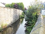
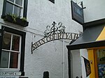
Pendleton is a small village and civil parish in Ribble Valley, within the county of Lancashire, England. It is close to the towns of Whalley and Clitheroe. The parish lies on the north west side of Pendle Hill below the Nick o' Pendle. The village is just off the A59, Liverpool to York main road, since the construction of the Clitheroe By-Pass. Older roads through the parish include one from Clitheroe to Whalley which passes through the Standen area and another to Burnley which passes Pendleton Hall.Pendleton Brook runs down the centre of Main Street in the village. The village pub, the Swan with Two Necks, won the Campaign for Real Ale's (CAMRA) national pub of the year award in 2013.According to the 2001 census, the parish had a population of 203; however, the United Kingdom Census 2011 grouped the parish with Mearley and Worston (2001 pop. 25 and 76), giving a total of 349.The parish adjoins the other Ribble Valley parishes of Clitheroe, Mearley, Sabden, Wiswell, Barrow and Little Mitton. Higher areas of the parish, west of the village, are part of the Forest of Bowland Area of Outstanding Natural Beauty (AONB).
Excerpt from the Wikipedia article Pendleton, Lancashire (License: CC BY-SA 3.0, Authors, Images).Pendleton, Lancashire
Ribble Valley Pendleton
Geographical coordinates (GPS) Address Nearby Places Show on map
Geographical coordinates (GPS)
| Latitude | Longitude |
|---|---|
| N 53.851 ° | E -2.371 ° |
Address
BB7 1PZ Ribble Valley, Pendleton
England, United Kingdom
Open on Google Maps


