place

Harz National Park

1990 establishments in East Germany1994 establishments in Germany2006 establishments in GermanyHarzIUCN Category II
Important Bird Areas of GermanyNational parks of GermanyNature reserves in Lower SaxonyOsterode (district)Protected areas established in 1990Protected areas established in 1994Protected areas established in 2006Protected areas of Lower SaxonyProtected areas of Saxony-Anhalt
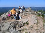
Blick vom Brocken zum Wurmberg 3

Harz National Park is a nature reserve in the German federal states of Lower Saxony and Saxony-Anhalt. It comprises portions of the western Harz mountain range, extending from Herzberg and Bad Lauterberg at the southern edge to Bad Harzburg and Ilsenburg on the northern slopes. 95% of the area is covered with forests, mainly with spruce and beech woods, including several bogs, granite rocks and creeks. The park is part of the Natura 2000 network of the European Union. In its current form, the park was created on January 1, 2006, by the merger of the Harz National Park in Lower Saxony, established in 1994, and the Upper Harz National Park in Saxony-Anhalt, established in 1990. As the former inner German border ran through the Harz, large parts of the range were prohibited areas, that apart from the fortifications had remained completely unaffected for decades. Today the park covers parts of the districts of Goslar, Göttingen and Harz. Rare animals of the Harz National Park include the white-throated dipper, the black stork, peregrine falcon, the European wildcat and especially the Eurasian lynx. The last lynx in the Harz Mountains had been shot in 1818, but in 1999 a project for reintroducing was established. Since 2002 several wild lynxes gave birth. An attempt to return the western capercaillie (Auerhuhn) however did not succeed.

Excerpt from the Wikipedia article Harz National Park (License: CC BY-SA 3.0, Authors, Images).

Harz National Park
Schierker Straße, Harz (LK Goslar)

Geographical coordinates (GPS) Address Nearby Places
placeShow on map

Wikipedia: Harz National ParkContinue reading on Wikipedia

Geographical coordinates (GPS)

Latitude Longitude
N 51.783333333333 ° E 10.566666666667 °
placeShow on map

Address

Schierker Straße
38667 Harz (LK Goslar)
Lower Saxony, Germany
mapOpen on Google Maps

Blick vom Brocken zum Wurmberg 3
Share experience

Nearby Places

Dreieckiger Pfahl
Dreieckiger Pfahl

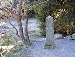
The Dreieckige Pfahl ("Triangular Post") is a historic boundary stone, about 1.35 metres high and made of granite, located southwest of the Brocken, the highest mountain in the Harz Mountains of central Germany. The stone, erected before 1866, marked the border between the Kingdom of Hanover and the Duchy of Brunswick. Originally this spot was a tripoint. During the division of Germany the border between the German Democratic Republic and the Federal Republic of Germany ran past the Dreieckiger Pfahl. Today it marks the border between the states of Saxony-Anhalt and Lower Saxony, the post lying just within the Lower Saxon side. During the Cold War it was accessible from the west. The historic stone stands at an elevation of about 870 metres, around 2.5 kilometres east of a car park on the B 4 federal road between Torfhaus and Oderbrück. The first recorded mention of a boundary stone being located here dates to the year 1727. On a map of the Upper Forest of Braunlage (Oberforst Braunlage) is the note "drey Eckjer Pfahl anno 1698". From a description of the Harzburg Forest (Harzburger Forsten) the original stone is described thus: Solcher Pfahl ist auch nach Communion Seite zur linken Hand mit Nr. 1 und einer Wolfsangel, nach Braunlagischer Seite mit drey Hieben und auf Elbingeroder Seite mit Nr. 1 und einem Kreuz ingleichen mit der Jahreszahl 1698 gesetzt und hat dabei seinen Namen erhalten. ...which translates roughly as... Such a post was also erected with a No. 1 and a wolfsangel inscribed on the left hand side facing Communion, three gashes on the Elbingerode side, and a No. 1 and a cross with the year 1698 inscribed on the Braunlage side; hence its name. The boundary markers were subsequently replaced on a regular basis. In 1736 a wooden post was erected and, in 1791, one made of stone. In 1844 a new post was made in oakwood. The present triangular stone was erected before 1866. It bears the No. 1 and, on its northeastern and southwestern sides the letters KH for Kingdom of Hanover, and on the southeastern side the letters HB for the Duchy of Brunswick (Herzogtum Braunschweig). The original triangular shape was retained. In 1894 a railway station was planned at the site of the Dreieckiger Pfahl. Engineer Louis Degen, who had drawn up plans for a Harz railway running on the territory of Brunswick from Walkenried via Wieda to Braunlage (later called the South Harz Railway), envisaged an extension of the line to the most northerly point of this piece of Brunswick terrain – the district of Blankenburg. Previously, in 1892, the construction of a road requested by several parishes in the West Harz, which would have branched off at the Dreieckiger Pfahl from the road from Torfhaus/Oderbrück to Schierke and run to the Brocken Road, had been refused by the Chamber of the Principality of Stolberg-Wernigerode. The station was to have been equipped with a run-around loop. However the railway was only built as far as Braunlage. A goods track ran to the north of Braunlage to the granite quarry on the Wurmberg mountain, but it never reached the Dreieckiger Pfahl. Until 1945 there was a small restaurant at the Dreieckiger Pfahl, which was mainly frequented by hikers to the Brocken. The building was burnt down by American troops in April 1945, because SS and Wehrmacht soldiers as well as Hitler Youth had been hiding in huts in this area. The pub was never rebuilt. Today, there is a rest area for hikers and mountain bikers in the vicinity of the Dreieckiger Pfahl as well as box no. 168 on the Harzer Wandernadel network of hiking checkpoints.

Brocken Transmitter
Brocken Transmitter

The Brocken Transmitter (German: Sender Brocken) is a facility for FM- and TV-transmitters on the Brocken, the highest mountain in Northern Germany. The facility includes two transmission towers. The old tower was built between 1936 and 1937. It is 53 metres high (including its antenna mast, which no longer exists, it had a height of 95 metres) and has an observation deck, which can be reached by elevator. This tower was intended to be used after 1939 for TV transmissions to central Germany, but due to the beginning of World War II, it was transformed into a radar facility. Unlike most modern TV towers, the old tower looks like a block of flats with a square cross section. The arrangement of the windows in the observation deck is similar to those in the restaurant in the Radio tower Berlin. In 1973 a new TV tower was built on Brocken. This 123-metre, freestanding steel-tube tower stands on three legs, which hold shafts for cable and stairways for personnel access. Above the legs are three decks for directional radio transmission aerials. The new TV tower is not accessible to the public. While Germany was divided into East and West, the Brocken transmitter was used for TV and FM-transmissions, even though it lay in the restricted area of the east-west frontier (on the Eastern Side). Its location so close to the border enabled it to be received in parts of the West. In the first half of the 1990s the transmitting aerial of the old tower was removed and replaced by a radome holding air traffic control radar equipment. The Brocken Transmitter is property of Deutsche Telekom.