Harz
Carboniferous GermanyCentral UplandsClimbing areas of GermanyCretaceous GermanyForests and woodlands of Lower Saxony ... and 14 more
Forests and woodlands of Saxony-AnhaltForests and woodlands of ThuringiaHarzHorsts (geology)Mountain ranges of GermanyMountain ranges of ThuringiaMountains and hills of Saxony-AnhaltMountains of Lower SaxonyNatural regions of GermanyPages including recorded pronunciationsPages with German IPARegions of Lower SaxonyRegions of Saxony-AnhaltRegions of Thuringia

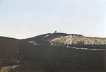
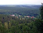
The Harz (German: [haːɐ̯ts] ) is a highland area in northern Germany. It has the highest elevations for that region, and its rugged terrain extends across parts of Lower Saxony, Saxony-Anhalt, and Thuringia. The name Harz derives from the Middle High German word Hardt or Hart (hill forest). The name Hercynia derives from a Celtic name and could refer to other mountain forests, but has also been applied to the geology of the Harz. The Brocken is the highest summit in the Harz with an elevation of 1,141.1 metres (3,744 ft) above sea level. The Wurmberg (971 metres (3,186 ft)) is the highest peak located entirely within the state of Lower Saxony.
Excerpt from the Wikipedia article Harz (License: CC BY-SA 3.0, Authors, Images).Harz
Grenzweg, Oberharz am Brocken
Geographical coordinates (GPS) Address Nearby Places Show on map
Geographical coordinates (GPS)
| Latitude | Longitude |
|---|---|
| N 51.75 ° | E 10.633333333333 ° |
Address
Grenzweg (Ehem. Kolonnenweg)
Grenzweg
38875 Oberharz am Brocken
Saxony-Anhalt, Germany
Open on Google Maps


