place

Panhandle (San Francisco)
1870 establishments in CaliforniaGolden Gate ParkHaight-Ashbury, San FranciscoParks in San FranciscoProtected areas established in 1870
Western Addition, San Francisco
Panhandle
Panhandle

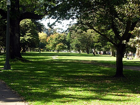
The Panhandle is a public park in San Francisco, California, so named because it forms a panhandle with Golden Gate Park. It is long and narrow, being three-quarters of a mile (eight blocks) long and just one block wide. Fell and Oak Streets border it to the north and south, Baker Street to the east, and to the west Stanyan Street which separates the smaller Panhandle from the much larger Golden Gate Park. One street crosses the Panhandle, Masonic Avenue, roughly in the middle. In its westernmost block, Oak and Fell Streets angle across the Panhandle, converge with one another, and continue west of Stanyan as John F. Kennedy Drive and Kezar Drive. Two paved walking paths, one allowing bicycles, run the entire length of the Panhandle from east to west, and several shorter ones criss-cross it north to south. In its western section, between Stanyan and Masonic, the Panhandle contains basketball courts, a public restroom, a playground, and an outdoor gym. The William McKinley Memorial is at the eastern end of the Panhandle, just across Baker Street from the DMV; it consists of a statue and seating area, and was dedicated in 1904 by President Theodore Roosevelt, who succeeded McKinley after his assassination in 1901.The Panhandle forms the southern boundary of the Western Addition neighborhood and the northern boundary of the Haight-Ashbury district.

Excerpt from the Wikipedia article Panhandle (San Francisco) (License: CC BY-SA 3.0, Authors, Images).

Panhandle (San Francisco)
Oak Street, San Francisco

Geographical coordinates (GPS) Address Nearby Places
placeShow on map

Wikipedia: Panhandle (San Francisco)Continue reading on Wikipedia

Geographical coordinates (GPS)

Latitude Longitude
N 37.772 ° E -122.45 °
placeShow on map

Address

Oak Street 1865
94117 San Francisco
California, United States
mapOpen on Google Maps

Panhandle
Panhandle
Share experience

Nearby Places

Booksmith
Booksmith

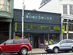
The Booksmith is an independent bookstore located in the Haight Ashbury neighborhood of San Francisco. When first opened in October 1976, the store was located at 1746 Haight Street, below the former I-Beam nightclub. In 1985, the store moved to its current location at 1644 Haight Street at Belvedere, about a block and a half from the intersection of Haight and Ashbury. Other neighborhood businesses include the Persian Aub Zam-Zam, Recycled Records, Amoeba Music, and Ben & Jerry's Ice Cream. Also located nearby is the Haight Ashbury Free Clinic. The Booksmith caters to neighborhood residents as well as tourists seeking the counter-cultural ambiance of Haight Street. The Booksmith is general interest shop, and is a member of both the Northern California Independent Booksellers Association (NCIBA) and the American Booksellers Association (ABA). In June 2007, The Booksmith was sold by its founder Gary Frank to married couple Christin Evans and Praveen Madan. The original business was closed, and a new business, Haight Booksmith LLC, opened in its place. According to media reports at the time, the new owners plan to take the store in a different direction.In May 2011, SF Weekly in its "Best of San Francisco" issue named Booksmith the city's "Best Reimagined Bookstore". Describing the changes to the bookstore, "The new owners gutted the clogged entranceway, feng shui-ed the interior, and gave it a cool Victorian steampunk black-and-teal paint job... with more than 200 in-store author readings a year, Booksmith is more of a literary mecca than ever."