place

Stretton Hall, Staffordshire

Country houses in StaffordshireGrade II* listed buildings in Staffordshire
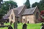
Stretton Hall, Stretton (geograph 3443721)

Stretton Hall is an early 18th-century mansion house at Stretton, South Staffordshire. It is the home of a branch of the Monckton family descended from John Monckton 1st Viscount Galway. It is a privately owned Grade II* listed building, not open to the public.The house built by John Congreve in about 1700 was originally two-storeyed with dormers above, a three-bay pedimented central block and two-bayed wings with a central pedimented entrance door. General Henry Monckton (1780–1854), a son of Edward Monckton and Sophia Pigot of Somerford Hall, purchased the estate in about 1845. He died in 1854, passing the estate on to his son, Francis Monckton. Four years later, Francis inherited Somerford, which had passed through the hands of two childless uncles, Edward and George. The Somerford inheritance included Coven and Engleton, two large neighbouring estates. Francis already resided at Stretton and moved the family seat there permanently, renting out Somerford Hall. In the 1860s he carried out extensive alterations at Stretton including a third storey and a new entrance front. Several members of the family have served as High Sheriff of Staffordshire, the latest being Mrs Joanna Bird Monckton in 1995.

Excerpt from the Wikipedia article Stretton Hall, Staffordshire (License: CC BY-SA 3.0, Authors, Images).

Stretton Hall, Staffordshire
Stoney Lane, South Staffordshire Lapley, Stretton and Wheaton Aston

Geographical coordinates (GPS) Address Nearby Places
placeShow on map

Wikipedia: Stretton Hall, StaffordshireContinue reading on Wikipedia

Geographical coordinates (GPS)

Latitude Longitude
N 52.703 ° E -2.1685 °
placeShow on map

Address

Stoney Lane
ST19 9LG South Staffordshire, Lapley, Stretton and Wheaton Aston
England, United Kingdom
mapOpen on Google Maps

Stretton Hall, Stretton (geograph 3443721)
Share experience

Nearby Places

Pennocrucium

Pennocrucium was a Romano-British settlement and military complex located at present day Water Eaton, just south of Penkridge, Staffordshire, with evidence of occupation from the mid-1st century until the 4th century.The settlement was mentioned in the 2nd century Antonine Itinerary, which described it as lying 12 miles from Uxacona (near present-day Oakengates) and 12 miles from Letocetum (Wall, near Lichfield). The exact site of Pennocrucium was identified only after aerial photography revealed cropmarks in 1946, and excavations were conducted by Kenneth St Joseph over subsequent years.Pennocrucium was an important road junction on Watling Street – the main Roman road across the Midlands to Viroconium Cornoviorum (Wroxeter) – and was situated 700 metres east of its crossing of the River Penk, with roads leading north to Mediolanum (Whitchurch) and south in the direction of Greensforge near Kinver and Metchley Fort in Birmingham.The main civilian defensive site or burgi was a rectangular enclosure approximately 450 feet (140 m) from north to south and 700 feet (210 m) from east to west, lying astride Watling Street and surrounded by three ditches. There may have been a civilian vicus around the defended settlement, possibly forming a ribbon development along Watling Street. 800 metres (2,600 ft) to the north east of the civilian settlement lay a large double-ditched enclosure identified as a possible Vexillation fortress, with two smaller forts lying 700 feet (210 m) south east of the settlement and 200 feet (60 m) north of Watling Street on the opposite bank of the Penk. Five single-ditched enclosures in the vicinity have been identified as temporary marching camps.

Speedwell Castle
Speedwell Castle

Speedwell Castle is a mid-18th-century house at the centre of Brewood, Staffordshire, between Wolverhampton and Stafford. Described by Pevsner as a "peach" and a "delectable folly", it stands beside the village market place, at the head of a T-junction on Bargate Street, facing onto Stafford Street. The house is an interesting combination of "Gothick" and Classical architecture: the symmetrical brick façade has two canted bays, each of three storeys, either side of a pillared entrance with ogee portico and octagonal-panelled door. There are five windows around each bay on each floor, and a single window on the two floors above the entrance, with decorative plasterwork arranged in tiers of round-headed arches with keystones and ogee arches rising to pinnacles surmounted by acorns. The glazing is arranged in a delicate tracery, originally of hexagons (although the glazing bars are not original on the ground and first floors). The façade is finished by a modillion cornice and parapet, concealing a hipped slate roof with brick chimney stacks. The interior includes one surviving decorative plaster ceiling and a Chinese Chippendale staircase with fretted balustrade. The house became a grade II listed building in 1953. The designer is unknown but some sources suggest Thomas Farnolls Pritchard, who worked nearby in Shropshire. The house has some similarities with Sandhurst House in Stourbridge, and Shenstone Hall near Lichfield. The design may have been inspired by the books published in the 1740s by Batty Langley, who attempted to improve Gothic forms by giving them classical proportions. Speedwell Castle was reputedly built by a local apothecary William Rock, using the winnings from betting on the Duke of Bolton's racehorse, Speedwell. (An alternate story is that the builder owned an unsuccessful racehorse, and said that he would build a castle to celebrate if it ever won). After a period as the home of the classics master at Brewood Grammar School in the second half of the 19th century, it became a reading room in the late 19th century. It was then used as shops and storage until the 1930s, when it was converted to residential flats.