Hazelbury, Wiltshire

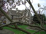
Hazelbury is a former village in the civil parish of Box, Wiltshire, England. It was about 0.5 miles (0.8 km) southeast of the present-day village of Box and 3 miles (5 km) south-west of the town of Corsham. There was a Roman villa. Hazelbury was recorded in the Domesday Book of 1086 as Haseberie, with 25 households and a church. The church fell into disuse before 1540. In the 1872 Imperial Gazetteer of England and Wales, Hazelbury is described as "once was a parish; and it still ranks as a rectory in the diocese of Gloucester and Bristol". The name is spelled Hasilbury in a 1900 book.Chapel Plaister, an ancient roadside church and hospice for pilgrims which still stands about half a mile to the south-east, was dependent on Hazelbury church.The extinction of the village probably followed the Black Death pandemic. Today only Hazelbury Manor survives: a 15th-century Grade I listed building in grounds of 186 acres (75 hectares).
Excerpt from the Wikipedia article Hazelbury, Wiltshire (License: CC BY-SA 3.0, Authors, Images).Hazelbury, Wiltshire
Wyres Lane,
Geographical coordinates (GPS) Address Nearby Places Show on map
Geographical coordinates (GPS)
| Latitude | Longitude |
|---|---|
| N 51.413888888889 ° | E -2.2377777777778 ° |
Address
Hazelbury Manor
Wyres Lane
SN13 8HY , Box
England, United Kingdom
Open on Google Maps


