place

J. P. Pulliam Generating Station

Buildings and structures in Brown County, WisconsinCoal-fired power stations in WisconsinEnergy infrastructure completed in 1927Energy infrastructure completed in 1943Energy infrastructure completed in 1947
Energy infrastructure completed in 1949Energy infrastructure completed in 1951Energy infrastructure completed in 1958Energy infrastructure completed in 1964Energy infrastructure completed in 2003
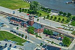
J. P. Pulliam Generating Station, Green Bay, Wisconsin (9179672863)

J. P. Pulliam Generating Station was an electrical power station powered by sub-bituminous coal, which could also be substituted by natural gas. It was located in Green Bay, Wisconsin in Brown County. The plant was named after the former Wisconsin Public Service Corporation president John Page Pulliam (–June 15, 1951). The plant units were connected to the power grid via 138 kV and 69 kV transmission lines. The remaining coal units on site were decommissioned in 2018 leaving only the natural gas fired P31 unit active at the site.

Excerpt from the Wikipedia article J. P. Pulliam Generating Station (License: CC BY-SA 3.0, Authors, Images).

J. P. Pulliam Generating Station
Bylsby Avenue, Green Bay

Geographical coordinates (GPS) Address Nearby Places
placeShow on map

Wikipedia: J. P. Pulliam Generating StationContinue reading on Wikipedia

Geographical coordinates (GPS)

Latitude Longitude
N 44.54 ° E -88.008611111111 °
placeShow on map

Address

Bylsby Avenue
54303 Green Bay
Wisconsin, United States
mapOpen on Google Maps

J. P. Pulliam Generating Station, Green Bay, Wisconsin (9179672863)
Share experience

Nearby Places

Fox River (Green Bay tributary)

The Fox River is a river in eastern Wisconsin in the Great Lakes region of the United States. It is the principal tributary of Green Bay, and via the Bay, the largest tributary of Lake Michigan. The well-known city of Green Bay, one of the first European settlements in North America, is on the river at its mouth on lower Green Bay. Hydrographers divide the Fox into two distinct sections, the Upper Fox River, flowing from its headwaters in south-central Wisconsin northeasterly into Lake Winnebago, and the Lower Fox River, flowing from Lake Winnebago northeasterly to lower Green Bay. Together, the two sections give the Fox River a length of 182 miles (293 km). Counting the distance through Lake Winnebago gives a total of 200 miles (322 km).The Fox River (Green Bay tributary) should not be confused with the Fox River (Illinois River tributary) which also flows through Wisconsin having its origin starting at a point approximately 10 miles northwest of Menomonee Falls, Wisconsin, and flowing through the cities of Waukesha, Mukwonago and Burlington, before flowing out of Wisconsin into Illinois. The Fox River (Illinois tributary) is the bigger of the two rivers flowing from southeast Wisconsin and terminating in Ottawa, Illinois where it joins the Illinois River, for an estimated journey of 202 miles (325 km).The river's name is the English translation of the French name for the Meskwaki people in the 17th century. The river was part of the famous 1673–74 expedition of Jolliet and Marquette, in which they went on to become the first Europeans to traverse the upper Mississippi River. A particular set of cities on the lower Fox River identify themselves as the "Fox Cities".