place

Bredon Hill

Hill forts in WorcestershireHills of WorcestershireMarilyns of EnglandSites of Special Scientific Interest in WorcestershireSpecial Areas of Conservation in England
Bredon Hill
Bredon Hill

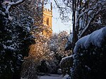
Bredon Hill is a hill in Worcestershire, England, south-west of Evesham in the Vale of Evesham. The summit of the hill is in the parish of Kemerton, and it extends over parts of eight other parishes (listed below). The hill is geologically part of the Cotswolds and lies within the Cotswolds Area of Outstanding Natural Beauty. However, it now stands isolated in the Vale of Evesham due to natural causes. At the summit, adjacent to Kemerton Camp, is a small stone tower called Parsons Folly which stands at GPS coordinates (52.059963, -2.064606). The tower was built in the mid-18th century for John Parsons, MP (1732–1805), squire of Kemerton Court and intended as a summer house, from which a more extensive view of the surrounding countryside could be seen. The 981-foot (299 m) natural height of the hill contributes to the final height of the tower, whose top now reaches 1,000 feet (305 m). The folly (tower) became a well-known county landmark, and was believed to have inspired the building of Broadway Tower. The current owners, Overbury Estate, lease out the tower as a mobile phone base station, and a number of large aerials have been fitted to its exterior.

Excerpt from the Wikipedia article Bredon Hill (License: CC BY-SA 3.0, Authors, Images).

Bredon Hill
Double Hedges Road, Wychavon

Geographical coordinates (GPS) Address Nearby Places
placeShow on map

Wikipedia: Bredon HillContinue reading on Wikipedia

Geographical coordinates (GPS)

Latitude Longitude
N 52.06016 ° E -2.06267 °
placeShow on map

Address

Kemerton Camp Hill Fort

Double Hedges Road
GL20 7PH Wychavon
England, United Kingdom
mapOpen on Google Maps

Bredon Hill
Bredon Hill
Share experience

Nearby Places

Kemerton
Kemerton

Kemerton is a village and civil parish in Worcestershire in England. It lies at the extreme south of the county in the local government district of Wychavon. Until boundary changes in 1931, it formed part of neighbouring Gloucestershire, and it remains in the Diocese of Gloucester. The northern half of the parish lies within the Cotswolds Area of Outstanding Natural Beauty. The parish is approximately 5.8 km (3.6 miles) long by 1.2 km (0.7 miles) wide, and encompasses approximately 6.738 square kilometres (1,665 acres). It descends from the summit of Bredon Hill in the north, (elevation 300 m / 981 ft) to the Carrant Brook in the south (elevation 20 m / 65 ft). The north and south parish boundaries are recorded in a Saxon charter of the 8th century. Notable historic features include Kemerton Camp, an Iron Age hill fort surmounting Bredon Hill, thought to have been vacated suddenly after a considerable battle. On the fort's south rampart is a two-storey stone tower known as Parsons Folly (or the Tower), built in the mid-18th century by John Parsons V, MP (1732–1805), the squire of Kemerton, who reputedly wished to raise the summit of Bredon Hill to 1000 ft (305 m). Significant buildings include the Church of St Nicholas and Kemerton Court, both of which are listed Grade II*.The parish includes several important wildlife sites including the Kemerton Lake Nature Reserve and sections of the Bredon Hill Special Area of Conservation, which are managed by Kemerton Conservation Trust. Well known residents of Kemerton have included the anarchist publisher Charlotte Wilson and the bestselling author John Moore.