Morley, West Yorkshire

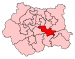
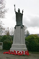
Morley is a market town and a civil parish within the City of Leeds metropolitan borough, in West Yorkshire, England. Morley is the largest town in the borough after Leeds itself. Morley forms part of the Heavy Woollen District. It lies approximately 5 miles (8 km) south-west of Leeds city centre. It was built on seven hills: Scatcherd Hill, Dawson Hill, Daisy Hill, Chapel Hill, Hunger Hill, Troy Hill and Banks Hill. In 2011, the town and civil parish had populations of 44,440 and 27,738 respectively.The town is split between the Morley North and Morley South wards (containing the town centre) of Leeds City Council, both making up the western half of the Morley and Outwood parliamentary constituency.
Excerpt from the Wikipedia article Morley, West Yorkshire (License: CC BY-SA 3.0, Authors, Images).Morley, West Yorkshire
Brunswick Street, Leeds Bruntcliffe
Geographical coordinates (GPS) Address Nearby Places Show on map
Geographical coordinates (GPS)
| Latitude | Longitude |
|---|---|
| N 53.749166 ° | E -1.602263 ° |
Address
Brunswick Street
Brunswick Street
LS27 9DH Leeds, Bruntcliffe
England, United Kingdom
Open on Google Maps


