place

East Geelong, Victoria

Barwon South West geography stubsSuburbs of GeelongUse Australian English from January 2018

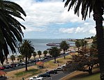
East Geelong is a residential suburb of Geelong, Victoria, Australia. At the 2016 census, East Geelong had a population of 3,862.The post office opened on 6 June 1921. An earlier Post Office dating from 1871 was later renamed Moolap West.The 81-hectare Eastern Park is located in East Geelong. It is Geelong's premier regional park and an important recreation focus for central Geelong. The Geelong Botanic Gardens are located at its centre.East Geelong has an Australian Rules football team competing in the Geelong & District Football League. Golfers play at the course of the East Geelong Golf Club at Eastern Gardens.

Excerpt from the Wikipedia article East Geelong, Victoria (License: CC BY-SA 3.0, Authors).

East Geelong, Victoria
Humble Street, Geelong East Geelong

Geographical coordinates (GPS) Address Nearby Places
placeShow on map

Wikipedia: East Geelong, VictoriaContinue reading on Wikipedia

Geographical coordinates (GPS)

Latitude Longitude
N -38.162 ° E 144.3802 °
placeShow on map

Address

Humble Street

Humble Street
3219 Geelong, East Geelong
Victoria, Australia
mapOpen on Google Maps

Share experience

Nearby Places

Corio Oval
Corio Oval

Corio Oval was an Australian rules football ground, located in Geelong, Victoria, and used by the Geelong Football Club in the VFA and the VFL from 1878 to 1915, and 1917 to 1940. Sited in Eastern Park, the oval was served by trams from 1930 when the line was extended along Ryrie Street to the football ground.Corio Oval had been in use as a cricket oval since 1862, when a Geelong and District XXII played an All-England XI. Several more cricket matches against international touring teams were played at the ground until 1937.In 1878, Corio Oval became the home ground of the Geelong Football Club, after they left Argyle Square due to a dispute over rent, although one game was played at the old ground in 1878 when Corio Oval was flooded. While Geelong went into recess in 1916 due to the First World War, the club remained at Corio Oval until the end of the 1940 season, when they were forced to relocate after the venue became the first major VFL ground to be used by the Army as a Military Training Camp during World War II. Kardinia Park was decided upon as a temporary replacement, with the Corio Oval ticket boxes and turnstiles being relocated to the new venue for the start of the 1941 season. Due to travel restrictions, petrol rationing, and an exodus of players to serve in the armed forces, the club went into recess in 1942 and 1943: at the start of the 1944 season, there was much debate over whether to return to Corio Oval, but the supporters of Kardinia Park won out. After the departure of the military, Corio Oval was vacant until 1956, when the Geelong Trotting Club held its inaugural meeting there. In the same year, the Geelong Greyhound Racing Club began to use a new track constructed for greyhound racing inside the trotting circuit, employing a mechanical "tin hare" as the lure.In the 1970s, plans were announced for the new Australian Animal Health Laboratory to be built near Eastern Park. Because the new facility was designed to deal with highly infectious diseases, large congregations of animals could not be permitted in the vicinity, and the greyhound and trotting clubs left Corio Oval in 1978, moving to a newly constructed complex at Beckley Park, adjacent to the Princes Highway in Corio. In 1981, the oval finally ceased to exist when the surviving main grandstand was demolished, and a conference centre, now owned by the Salvation Army, was constructed on the site.The attendance record for Corio Oval was set on 29 August 1925, when 26,025 fans saw Geelong defeat Collingwood by nine points, a record for a Geelong home match that was not broken until 1951. A total of 545 matches at the top level of Victorian senior football - 174 in the VFA and 371 in the VFL - were played at the ground in 62 seasons of competition.

Geelong city centre
Geelong city centre

The Geelong city centre is the urban center and main commercial locality of the Geelong metropolitan area, also referred to as the Geelong CBD, Central Geelong, the Central Activities Area, or informally simply as "Town" by locals. The name of the area is officially gazetted as Geelong.The Geelong city centre is the oldest part of Geelong and includes many of the city's historic landmarks such as the Geelong City Hall, St. Mary of the Angels Basilica, the T & G Building, Johnstone Park, Geelong railway station, and the old Geelong Post Office. It is also a cultural area for the region, housing the Geelong Art Gallery and the Geelong Arts Centre, as well as the Deakin University waterfront campus. Tourist attractions include the Waterfront Geelong, Eastern Beach, and the National Wool Museum. The city centre is one of Geelong's major shopping districts. Two large shopping malls, Westfield Geelong and Market Square Shopping Centre, have been opened in the last three decades, which has led to a decline in street shopping on the city's two main thoroughfares, Moorabool Street and Ryrie Street, resulting in a declining number of customers and some empty shops.The Geelong city centre has seen some significant redevelopment since 2016. In 2018, the WorkSafe office building was opened, followed by the National Disability Insurance Agency (NDIA) national headquarters in 2019, significantly altering the skyline. New multi-storey apartment buildings, such as The Mercer and The Miramar, have also been built recently.