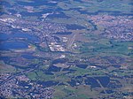
Albion Park, New South Wales
City of ShellharbourSuburbs of WollongongUse Australian English from August 2019

Albion Park is a suburb situated in the Macquarie Valley in the City of Shellharbour, which is in turn one of the three local government areas that comprise the Wollongong Metropolitan Area, New South Wales, Australia. Although it is surrounded by a 'green belt' of farms, Albion Park had a population of 13,316 at the 2016 census.The Illawarra escarpment is to the west, Dapto is to the north, Jamberoo is to the south and Shellharbour is to the east.
Excerpt from the Wikipedia article Albion Park, New South Wales (License: CC BY-SA 3.0, Authors, Images).Albion Park, New South Wales
Robyn Road, Shellharbour City Council
Geographical coordinates (GPS) Address Nearby Places Show on map
Geographical coordinates (GPS)
| Latitude | Longitude |
|---|---|
| N -34.566666666667 ° | E 150.8 ° |
Address
Robyn Road
Robyn Road
2527 Shellharbour City Council, Albion Park Rail
New South Wales, Australia
Open on Google Maps


