River Avon, Warwickshire

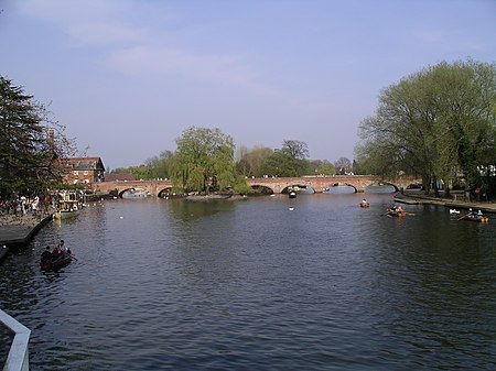
The River Avon () in central England flows generally southwestwards and is a major left-bank tributary of the River Severn, of which it is the easternmost. It is also known as the Warwickshire Avon or Shakespeare's Avon, to distinguish it from several other rivers of the same name in the United Kingdom. Beginning in Northamptonshire, the river flows through or adjoining the counties of Leicestershire, Northamptonshire, Warwickshire, Worcestershire and Gloucestershire, near the Cotswold Hills area. Notable towns it flows through include Rugby, Warwick, Stratford-upon-Avon, Evesham, Pershore and Tewkesbury, where it joins the Severn. It has traditionally been divided since 1719 into the Lower Avon, below Evesham, and the Upper Avon, from Evesham to above Stratford-upon-Avon. Improvements to aid navigation began in 1635, and a series of locks and weirs made it possible to reach Stratford, and to within 4 miles (6 km) of Warwick. The Upper Avon was tortuous and prone to flooding, and was abandoned as a means of navigation in 1877. The Lower Avon struggled on, and never really closed, although by 1945 it was only navigable below Pershore. Restoration of the lower river as a navigable waterway began in 1950, and was completed in 1962. The upper river was a more daunting task, as most of the locks and weirs were no longer extant. Work began in 1965 on the construction of nine new locks and 17 miles (27 km) of river, using mainly volunteer labour, and was completed in 1974 when it was opened by Queen Elizabeth the Queen Mother. The Avon connects with the Stratford-upon-Avon Canal in the centre of Stratford, and is used primarily by leisure craft. Plans to extend the navigable river to provide a link with the Grand Union Canal at either Warwick or Leamington Spa have met with some opposition.
Excerpt from the Wikipedia article River Avon, Warwickshire (License: CC BY-SA 3.0, Authors, Images).River Avon, Warwickshire
Mythe Road,
Geographical coordinates (GPS) Address Nearby Places Show on map
Geographical coordinates (GPS)
| Latitude | Longitude |
|---|---|
| N 51.9964 ° | E -2.1634 ° |
Address
Mythe Treatment Works
Mythe Road
GL20 6AA , Mythe
England, United Kingdom
Open on Google Maps


