Principality of Wales

The Principality of Wales (Welsh: Tywysogaeth Cymru) was originally the territory of the native Welsh princes of the House of Aberffraw from 1216 to 1283, encompassing two-thirds of modern Wales during its height of 1267–1277. Following the conquest of Wales by Edward I of England of 1277 to 1283, those parts of Wales retained under the direct control of the English crown, principally in the north and west of the country, were re-constituted as a new Principality of Wales and ruled either by the monarch or the monarch's heir though not formally incorporated into the Kingdom of England. This was ultimately accomplished with the Laws in Wales Acts 1535–1542 when the Principality ceased to exist as a separate entity. The Principality was formally founded in 1216 by native Welshman and King of Gwynedd, Llywelyn the Great who gathered other leaders of pura Wallia at the Council of Aberdyfi. The agreement was later recognised by the 1218 Treaty of Worcester between Llywelyn the Great of Wales and Henry III of England. The treaty gave substance to the political reality of 13th-century Wales and England, and the relationship of the former with the Angevin Empire. The principality retained a great degree of autonomy, characterized by a separate legal jurisprudence based on the well-established laws of Cyfraith Hywel, and by the increasingly sophisticated court of the House of Aberffraw. Although it owed fealty to the Angevin king of England, the principality was de facto independent, with a similar status in the empire to the Kingdom of Scotland. Its existence has been seen as proof that all the elements necessary for the growth of Welsh statehood were in place.The period of de facto independence ended with Edward I's conquest of the principality between 1277 and 1283. Under the Statute of Rhuddlan, the principality lost its independence and became effectively an annexed territory of the English crown. From 1301, the crown's lands in north and west Wales formed part of the appanage of England's heir apparent, with the title "Prince of Wales". On accession of the prince to the English throne, the lands and title became merged with the Crown again. On two occasions Welsh claimants to the title rose up in rebellion during this period, although neither ultimately succeeded. Since the Laws in Wales Acts 1535–1542, which formally incorporated all of Wales within the Kingdom of England, there has been no geographical or constitutional basis for describing any of the territory of Wales as a principality, although the term has occasionally been used in an informal sense to describe the country, and in relation to the honorary title of Prince of Wales.
Excerpt from the Wikipedia article Principality of Wales (License: CC BY-SA 3.0, Authors, Images).Principality of Wales
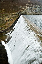
Elan Valley Trail,
Geographical coordinates (GPS) Address Nearby Places Show on map
Geographical coordinates (GPS)
| Latitude | Longitude |
|---|---|
| N 52.3 ° | E -3.6 ° |
Address
Elan Valley Trail
Elan Valley Trail
LD6 5HE , Rhayader
Wales, United Kingdom
Open on Google Maps


