Springfield, Missouri

Springfield is the 3rd most populous city in the U.S. state of Missouri, after Kansas City and St. Louis, and the county seat of Greene County. The city's population was 169,176 at the 2020 census. It is the principal city of the Springfield metropolitan area, which had an estimated population of 487,061 in 2022 and includes the counties of Christian, Dallas, Greene, Polk, and Webster, The city sits on the Springfield Plateau of the Ozarks, which ranges from nearly-level to rolling hills. Springfield is the second-largest urban area in the Ozarks. Springfield's nicknames include "Queen City of the Ozarks" and "The Birthplace of Route 66". The city has been called the "Buckle of the Bible Belt" due to its association with evangelical Christianity. The city is the headquarters for Bass Pro Shops and the adjoining Wonders of Wildlife Museum & Aquarium. Springfield is within close distance to Wilson's Creek National Battlefield and sits along the Trail of Tears, now a national historic trail. As of 2020, Springfield's largest ethnicities are 87.6% White, 4% Black, and 5% two or more races. The city is a regional center of medical care, with two of the largest hospitals in the area, CoxHealth and Mercy being the largest employers in the city. Springfield is home to several universities and colleges, including Missouri State University, Drury University, and Evangel University. Springfield is an important regional center for distribution, logistics and manufacturing.
Excerpt from the Wikipedia article Springfield, Missouri (License: CC BY-SA 3.0, Authors, Images).Springfield, Missouri
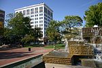
West Chestnut Street, Springfield
Geographical coordinates (GPS) Address Nearby Places Show on map
 Continue reading on Wikipedia
 Geographical coordinates (GPS)
| Latitude | Longitude |
|---|---|
| N 37.215277777778 ° | E -93.298333333333 ° |
Address
Heffington's Optiland
West Chestnut Street 640
65806 Springfield
Missouri, United States
Open on Google Maps