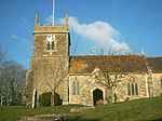
West Stour, Dorset
Villages in Dorset

West Stour is a village and civil parish situated in the Blackmore Vale area of North Dorset, England. It is one of a group of villages known as The Stours, located in the River Stour Valley, five miles (eight kilometres) south of Gillingham. West Stour has a village hall, one public house and a service station on the main A30 road. West Stour is one of four parishes—the others being East Stour, Stour Provost and Todber—under the governance of The Stours Parish Council. It has a population of about 200.The nearest railway station is at Gillingham. Trains run on the Exeter to Waterloo line.
Excerpt from the Wikipedia article West Stour, Dorset (License: CC BY-SA 3.0, Authors, Images).West Stour, Dorset
Geographical coordinates (GPS) Address Nearby Places Show on map
Geographical coordinates (GPS)
| Latitude | Longitude |
|---|---|
| N 51.0025 ° | E -2.3076 ° |
Address
SP8 5RP , West Stour
England, United Kingdom
Open on Google Maps


