place

East Dean, Gloucestershire

Forest of DeanFormer civil parishes in GloucestershireHamlets in Gloucestershire
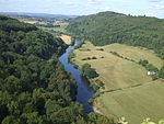
Wooded hillside, East Dean geograph.org.uk 1971323

East Dean is a hamlet and former civil parish, now in the parish of Mitcheldean, in the Forest of Dean district, in the county of Gloucestershire, England. East Dean became a township in 1844 and abolished as a civil parish on 1 April 1953.The Forest of Dean was an extra-parochial area in the St Briavels hundred of Gloucestershire. It was without the usual parish structure until the West Dean and East Dean townships were formed in 1844. For poor relief, East Dean was grouped into the Westbury-on-Severn Poor Law Union and was included in the Westbury-on-Severn rural sanitary district. Following the Local Government Act 1894, East Dean became a civil parish in the East Dean and United Parishes Rural District, which was renamed East Dean Rural District in 1935. The population of the parish was as follows: It occupied an area of 12,487 acres (50.53 km2) in 1881 and 12,860 acres (52.0 km2) in 1951.In 1935 a new civil parish of Lydbrook was created from part of its area and transferred to West Dean Rural District. The civil parish was abolished in 1953 and split to create the new parishes of Cinderford, Drybrook and Ruspidge. Part of the former area was transferred to the existing parishes of Awre, Littledean and Mitcheldean. The area of the former parish is now within the Forest of Dean district.

Excerpt from the Wikipedia article East Dean, Gloucestershire (License: CC BY-SA 3.0, Authors, Images).

East Dean, Gloucestershire
Family Cycle Route, Forest of Dean West Dean

Geographical coordinates (GPS) Address Nearby Places
placeShow on map

Wikipedia: East Dean, GloucestershireContinue reading on Wikipedia

Geographical coordinates (GPS)

Latitude Longitude
N 51.783333333333 ° E -2.55 °
placeShow on map

Address

Family Cycle Route

Family Cycle Route
GL15 4HS Forest of Dean, West Dean
England, United Kingdom
mapOpen on Google Maps

Wooded hillside, East Dean geograph.org.uk 1971323
Share experience

Nearby Places

Forest of Dean
Forest of Dean

The Forest of Dean is a geographical, historical and cultural region in the western part of the county of Gloucestershire, England. It forms a roughly triangular plateau bounded by the River Wye to the west and northwest, Herefordshire to the north, the River Severn to the south, and the City of Gloucester to the east. The area is characterised by more than 110 square kilometres (42 sq mi) of mixed woodland, one of the surviving ancient woodlands in England. A large area was reserved for royal hunting before 1066, and remained as the second largest crown forest in England, after the New Forest. Although the name is used loosely to refer to the part of Gloucestershire between the Severn and Wye, the Forest of Dean proper has covered a much smaller area since the Middle Ages. In 1327, it was defined to cover only the royal demesne and parts of parishes within the hundred of St Briavels, and after 1668 comprised the royal demesne only. The Forest proper is within the civil parishes of West Dean, Lydbrook, Cinderford, Ruspidge, and Drybrook, together with a strip of land in the parish of English Bicknor.Traditionally the main sources of work have been forestry – including charcoal production – iron working and coal mining. Archaeological studies have dated the earliest use of coal to Roman times for domestic heating and industrial processes such as the preparation of iron ore.The area gives its name to the local government district, Forest of Dean, and a parliamentary constituency, both of which cover wider areas than the historic Forest. The administrative centre of the local authority is Coleford, one of the main towns in the historic Forest area, together with Cinderford and Lydney.