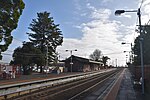
Bell Park, Victoria
Barwon South West geography stubsSuburbs of GeelongUse Australian English from January 2018

Bell Park is a residential suburb of Geelong, Victoria, Australia. It is located 3 km north-west of the Geelong city centre and is bordered to the north by Cowies Creek, to the east by Thompson Road, to the south by the Midland Highway and to the west by Anakie Road. At the 2016 Census, Bell Park had a population of 5,009.
Excerpt from the Wikipedia article Bell Park, Victoria (License: CC BY-SA 3.0, Authors, Images).Bell Park, Victoria
Separation Street, Geelong Bell Park
Geographical coordinates (GPS) Address Phone number Website Nearby Places Show on map
Geographical coordinates (GPS)
| Latitude | Longitude |
|---|---|
| N -38.11 ° | E 144.338 ° |
Address
Holy Family Primary School
Separation Street 143-147
3215 Geelong, Bell Park
Victoria, Australia
Open on Google Maps


