place

Metropolitan Grove station

1987 establishments in MarylandBrunswick LineBuildings and structures in Gaithersburg, MarylandMARC Train stationsMaryland railway station stubs
Railway stations in Montgomery County, MarylandRailway stations in the United States opened in 1987
Metropolitan Grove MARC train station crop Gaithersburg MD 2021 08 21 12 44 17 1

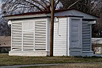
Metropolitan Grove is a passenger rail station on the MARC Brunswick Line between Washington, D.C. and Martinsburg, WV (with an extension to Frederick, MD). Metropolitan Grove Station is nearest Browns Station Park. The large Watkins Mill Town Center development is adjacent and still under construction. The future Corridor Cities Transitway light rail/bus rapid transit line will connect with MARC at Metropolitan Grove.

Excerpt from the Wikipedia article Metropolitan Grove station (License: CC BY-SA 3.0, Authors, Images).

Metropolitan Grove station
Metropolitan Court, Gaithersburg

Geographical coordinates (GPS) Address External links Nearby Places
placeShow on map

Wikipedia: Metropolitan Grove stationContinue reading on Wikipedia

Geographical coordinates (GPS)

Latitude Longitude
N 39.149722222222 ° E -77.226833333333 °
placeShow on map

Address

Metropolitan Grove

Metropolitan Court
20878 Gaithersburg
Maryland, United States
mapOpen on Google Maps

linkWikiData (Q6825105)
linkOpenStreetMap (367799271)

Metropolitan Grove MARC train station crop Gaithersburg MD 2021 08 21 12 44 17 1
Share experience

Nearby Places

Gaithersburg, Maryland

Gaithersburg ( GAY-thərz-burg), officially the City of Gaithersburg, is a city in Montgomery County, Maryland, United States. At the time of the 2020 U.S. Census, Gaithersburg had a population of 69,657, making it the ninth-largest community in the state. Gaithersburg is located to the northwest of Washington, and is considered a suburb and a primary city within the Washington–Arlington–Alexandria, DC–VA–MD–WV Metropolitan Statistical Area. Gaithersburg was incorporated as a town in 1878 and as a city in 1968. Gaithersburg is located east and west of Interstate 270. The eastern section includes the historic area of the town. Landmarks and buildings from that time can still be seen in many places but especially in the historic central business district of Gaithersburg called "Olde Towne". The east side also includes City Hall, and the Montgomery County Fair grounds, and Bohrer Park (a well-known joint community recreation center and outdoor water park for kids and families). The west side of the city has many wealthier neighborhoods that were designed with smart growth techniques and embrace New Urbanism. These include the Kentlands community, the Lakelands community, and the Washingtonian Center (better known as Rio), a shopping/business district. Two New Urbanism communities are under construction, including Watkins Mill Town Center (Casey East and West), and the massive "Science City". The state has a bus rapid transit line, Corridor Cities Transitway or "CCT", planned for the western portion of the city starting at Shady Grove Metro Station and connecting all the high density western Gaithersburg neighborhoods with a total of eight stops planned in the city. The National Institute of Standards and Technology (NIST) is headquartered in Gaithersburg directly west of I-270. Other major employers in the city include IBM, Lockheed Martin Information Systems and Global Services business area headquarters, AstraZeneca, and the French multinational corporation, Sodexo. Gaithersburg is also the location of the garrison of the United States Army Reserve Legal Command. Gaithersburg is noted for its ethnic and economic diversity; it was ranked second for ethnic diversity among the 501 largest U.S. cities, and first among smaller U.S. cities, by WalletHub in 2021.