Gmina Jerzmanowice-Przeginia
Gminas in Lesser Poland VoivodeshipKraków County

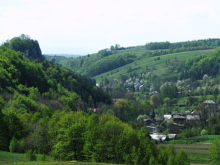
Gmina Jerzmanowice-Przeginia is a rural gmina (administrative district) in Kraków County, Lesser Poland Voivodeship, in southern Poland. Its seat is the village of Jerzmanowice, which lies approximately 22 kilometres (14 mi) north-west of the regional capital Kraków. The gmina covers an area of 68.39 square kilometres (26.4 sq mi), and as of 2006 its total population is 10,432. The gmina contains part of the protected area called Kraków Valleys Landscape Park.
Excerpt from the Wikipedia article Gmina Jerzmanowice-Przeginia (License: CC BY-SA 3.0, Authors, Images).Gmina Jerzmanowice-Przeginia
Centralna, gmina Jerzmanowice-Przeginia
Geographical coordinates (GPS) Address Nearby Places Show on map
Geographical coordinates (GPS)
| Latitude | Longitude |
|---|---|
| N 50.2175 ° | E 19.756944444444 ° |
Address
Centralna 4
32-048 gmina Jerzmanowice-Przeginia
Lesser Poland Voivodeship, Poland
Open on Google Maps


