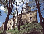
Białopole, Lower Silesian Voivodeship
Villages in Zgorzelec CountyZgorzelec County geography stubs

Białopole [bjawɔˈpɔlɛ] is a village in the administrative district of Gmina Bogatynia, within Zgorzelec County, Lower Silesian Voivodeship, in south-western Poland, close to the Czech and German borders.It lies approximately 7 kilometres (4 mi) south-west of Bogatynia, 31 kilometres (19 mi) south of Zgorzelec, and 153 kilometres (95 mi) west of the regional capital Wrocław.
Excerpt from the Wikipedia article Białopole, Lower Silesian Voivodeship (License: CC BY-SA 3.0, Authors, Images).Białopole, Lower Silesian Voivodeship
Graniczna, gmina Bogatynia
Geographical coordinates (GPS) Address Nearby Places Show on map
Geographical coordinates (GPS)
| Latitude | Longitude |
|---|---|
| N 50.880277777778 ° | E 14.901111111111 ° |
Address
Graniczna 22
59-921 gmina Bogatynia
Lower Silesian Voivodeship, Poland
Open on Google Maps


