Province of Cagliari
Province of CagliariProvinces of Italy

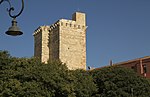
Cagliari (Italian: provincia di Cagliari; Sardinian: provìntzia de Casteddu) was a province in the autonomous island region of Sardinia, Italy and its capital city was Cagliari. It had an area of 4,470 square kilometres (1,730 sq mi), and a total population of 543,310 (2001). There were 71 comuni (singular: comune) in the province [1]. The historical province was suppressed by the 2016 Regional Decree Province of Cagliari and replaced by the Metropolitan City of Cagliari.
Excerpt from the Wikipedia article Province of Cagliari (License: CC BY-SA 3.0, Authors, Images).Province of Cagliari
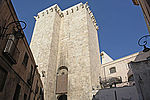
Piazza Palazzo, Cagliari Castello
Geographical coordinates (GPS) Address Nearby Places Show on map
 Continue reading on Wikipedia
 Geographical coordinates (GPS)
| Latitude | Longitude |
|---|---|
| N 39.2192 ° | E 9.11722 ° |
Address
Palazzo Reale
Piazza Palazzo
09125 Cagliari, Castello
Sardinia, Italy
Open on Google Maps