Høje-Taastrup Municipality

Høje-Taastrup Kommune is a municipality (Danish, kommune) in Region Hovedstaden on the island of Zealand (Sjælland) in eastern Denmark. The municipality covers an area of 78 km² (30 mi²), and has a total population of 55,258 (1. January 2023). It was formed by the 1970 Danish Municipal Reform, and its 1974 adjustment, by merging the parish municipalities of Høje Taastrup, Sengeløse, the Fløng part of Hvedstrup-Fløng and the Reerslev part of Reerslev-Vindinge. Since 1 January 2006 the mayor of the municipality has been Michael Ziegler, a member of the Conservative People's Party (Det Konservative Folkeparti) political party.
Excerpt from the Wikipedia article Høje-Taastrup Municipality (License: CC BY-SA 3.0, Authors, Images).Høje-Taastrup Municipality
Høje Taastrup Boulevard, Høje-Taastrup Municipality
Geographical coordinates (GPS) Address Website Nearby Places Show on map
Geographical coordinates (GPS)
| Latitude | Longitude |
|---|---|
| N 55.6477 ° | E 12.27 ° |
Address
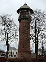
Thorstårn
Høje Taastrup Boulevard
2630 Høje-Taastrup Municipality, Høje Taastrup
Capital Region of Denmark, Denmark
Open on Google Maps


