place

Elizabethton Covered Bridge

Bridges completed in 1882Buildings and structures in Carter County, TennesseeCovered bridges on the National Register of Historic Places in TennesseeElizabethton, TennesseeFestivals in Tennessee
Historic American Buildings Survey in TennesseeHistoric American Engineering Record in TennesseeHistoric district contributing properties in TennesseeHowe truss bridges in the United StatesNRHP infobox with nocatNational Register of Historic Places in Carter County, TennesseeRoad bridges on the National Register of Historic Places in TennesseeTourist attractions in Carter County, TennesseeTransportation in Carter County, TennesseeUse mdy dates from August 2023Wooden bridges in Tennessee
ElizabethtonCoveredBridge2

The Elizabethton Covered Bridge is a 134-foot (41 m) covered bridge over the Doe River in Elizabethton, the county seat of Carter County, Tennessee. The Elizabethton Covered Bridge was constructed in 1882 and connects 3rd Street and Hattie Avenue.

Excerpt from the Wikipedia article Elizabethton Covered Bridge (License: CC BY-SA 3.0, Authors, Images).

Elizabethton Covered Bridge
3rd Street,

Geographical coordinates (GPS) Address External links Nearby Places
placeShow on map

Wikipedia: Elizabethton Covered BridgeContinue reading on Wikipedia

Geographical coordinates (GPS)

Latitude Longitude
N 36.3473 ° E -82.2118 °
placeShow on map

Address

Elizabethton Covered Bridge

3rd Street
37643
Tennessee, United States
mapOpen on Google Maps

linkWikiData (Q5363853)
linkOpenStreetMap (705788644)

ElizabethtonCoveredBridge2
Share experience

Nearby Places

Sycamore Shoals
Sycamore Shoals

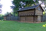
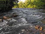
The Sycamore Shoals of the Watauga River, usually shortened to Sycamore Shoals, is a rocky stretch of river rapids along the Watauga River in Elizabethton, Tennessee. Archeological excavations have found Native Americans lived near the shoals since prehistoric times, and Cherokees gathered there. As Europeans began settling the Trans-Appalachian frontier, the shoals proved strategic militarily, as well as shaped the economies of Tennessee and Kentucky. Today, the shoals are protected as a National Historic Landmark and are maintained as part of Sycamore Shoals State Historic Park.Explorer James Robertson (later a founder of Nashville) identified the alluring flatlands at Sycamore Shoals, known as the Watauga Old Fields, in 1770, and led a group of colonists to the area shortly thereafter. In 1772, the Watauga settlers established the Watauga Association, one of the first constitutional governments west of the Appalachian Mountains and the "germ-cell" of what would later become the state of Tennessee.In 1775, Richard Henderson and Daniel Boone negotiated the Treaty of Sycamore Shoals, in which Henderson's Transylvania Company purchased a large part of modern Kentucky and part of Tennessee from the Cherokee. The following year, the Watauga settlers successfully repelled one arm of a Cherokee group contesting land near Fort Watauga in a struggle that saw the creation of numerous stories surrounding figures such as Nancy Ward and John Sevier. In 1780, at the height of the American Revolutionary War, the frontier militia known as the Overmountain Men mustered at Sycamore Shoals as it prepared to march across the mountains en route to victory over British loyalists at the Battle of Kings Mountain.