place

Bristol St Philip's railway station

Disused railway stations in BristolFormer Midland Railway stationsPages with no open date in Infobox stationRailway stations in Great Britain closed in 1953Railway stations in Great Britain opened in 1870
South West England railway station stubsUse British English from March 2015
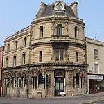
Bristol St Philips Station (remains) geograph.org.uk 1909537

St Philip's railway station was a small terminus station in Bristol built by the Midland Railway to relieve pressure on the main station at Bristol Temple Meads, which it shared with the Great Western Railway. The station had a single platform and was used principally by the local services between Bristol and Bath Green Park, via Mangotsfield. St Philip's was created by the Midland in part of its extensive goods yard in Bristol and opened in 1870, the company having opened the line from Mangotsfield into Bath the previous year. The station was sited close to the Old Market shopping area and also attracted commuter traffic. The Old Market area was badly bombed during World War II, and Bristol's shopping district was rebuilt elsewhere. St Philips Goods Station was renamed Midland Road on 15 September 1952. The local passenger trains were rerouted into Temple Meads and the passenger station closed on 21 September 1953. Midland Road goods station closed on 1 April 1967. Since closure the station was demolished and its site was redeveloped for light industrial units.

Excerpt from the Wikipedia article Bristol St Philip's railway station (License: CC BY-SA 3.0, Authors, Images).

Bristol St Philip's railway station
Midland Road, Bristol St Philip's

Geographical coordinates (GPS) Address Nearby Places
placeShow on map

Wikipedia: Bristol St Philip's railway stationContinue reading on Wikipedia

Geographical coordinates (GPS)

Latitude Longitude
N 51.45455 ° E -2.57851 °
placeShow on map

Address

Midland Road
BS2 0JY Bristol, St Philip's
England, United Kingdom
mapOpen on Google Maps

Bristol St Philips Station (remains) geograph.org.uk 1909537
Share experience

Nearby Places

Old Market, Bristol
Old Market, Bristol

Old Market is a Conservation Area of national significance, to the east of the city centre in Bristol, England. Old Market Street and West Street form the central axis of the area, which is approximately bounded by New Street and Lawfords Gate to the north, Trinity Road and Trinity Street to the east, Unity Street and Waterloo Road to the south and Temple Way Underpass to the west. Old Market Street is an ancient market place which developed immediately outside the walls of Bristol Castle on what was for many centuries the main road to London (now the A420); on market days Jacob Street and Redcross Street, which run parallel to Old Market Street, took the through traffic. Old Market's Pie Poudre Court, which dealt out summary justice to market-day offenders, was not formally abolished until 1971. The area contains some of Bristol's most ancient buildings, including the last two remaining houses jettied over the pavement and over sixty listed buildings. Old Market suffered decades of neglect and severe decline in the mid-20th century due to the removal of Bristol's historic central shopping area from Castle Street to Broadmead and the construction of Temple Way Underpass and Easton Way, which severed it from Bristol's pre-war shopping axis in both directions. Some important buildings still suffer from neglect, but the actions of local conservationists together with grant-aided schemes in the wake of its declaration as a Conservation Area in 1979 have done much to arrest the decline. Old Market has in recent years become a centre of Bristol's gay scene, and has been proclaimed as ‘Bristol’s Gay Village’.