place

St Giles' Church, Reading

Anglo-Catholic church buildings in BerkshireAnglo-Catholic churches in England receiving AEOChurch of England church buildings in BerkshireChurches in Reading, BerkshireGrade II listed buildings in Reading
Grade II listed churches in BerkshireUse British English from February 2023
St Giles' Church, Reading

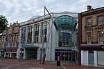
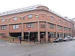
St Giles' Church is a Church of England parish church in the town of Reading in the English county of Berkshire.

Excerpt from the Wikipedia article St Giles' Church, Reading (License: CC BY-SA 3.0, Authors, Images).

St Giles' Church, Reading
Southampton Street, Reading Coley

Geographical coordinates (GPS) Address External links Nearby Places
placeShow on map

Wikipedia: St Giles' Church, ReadingContinue reading on Wikipedia

Geographical coordinates (GPS)

Latitude Longitude
N 51.450983333333 ° E -0.97040277777778 °
placeShow on map

Address

St Giles Church

Southampton Street
RG1 2QP Reading, Coley
England, United Kingdom
mapOpen on Google Maps

linkWikiData (Q7593265)
linkOpenStreetMap (95856027)

St Giles' Church, Reading
Share experience

Nearby Places

County Lock
County Lock

County Lock is a lock on the River Kennet in Reading town centre in the English county of Berkshire. It is now administered by the Canal & River Trust as part of the Kennet and Avon Canal. Downstream from the lock is Brewery Gut, a particularly fast flowing, narrow and dangerous stretch of the river.County Lock has the lowest rise of the locks on the Kennet, as boats only rise or fall about 30 cm (1 foot) in the lock. The main stream of the Kennet flows down the weir on the far side of the lock, while another arm of the Kennet disappears under the Bridge Street Roundabout.The first County Lock was built between 1718 and 1723, during the navigation works undertaken under the supervision of the engineer John Hore of Newbury in order to create the Kennet Navigation between Reading and Newbury. Initially the lock was located on the north side of the river, adjacent to Bear Wharf, but it was relocated to its current location on the south bank as part of the Reading waterworks improvement scheme of 1876.The land on both sides of the river adjacent to County Lock was formerly part of the site of Simonds Brewery. Brewery Gut takes its name from the brewery. In the days of horse haulage, this stretch of river had no towpath, and a long tow line had to be sent down-river on a specially designed float. To add to the difficulty, at its narrowest the gut is only 25 feet (7.6 m) wide, causing strong currents. Multiple vessels cannot safely pass due to the tortuous and narrow route, and there have been instances in the past of boats colliding and sinking. Today passage through the gut is controlled by traffic lights.Simonds' Brewery closed in the late 1970s, and most of the brewery buildings have been demolished. Around the lock itself they have been replaced by a mixture of apartments and offices, although the brewery's old stable building, which overlooks the lock, has been preserved and was formerly occupied by a Loch Fyne restaurant. The part of the brewery that enveloped Brewery Gut has been replaced by The Oracle shopping centre, and boats can be seen navigating through the middle of the Riverside Level of that complex, lined on both sides by restaurants and pubs.

Reading, Berkshire
Reading, Berkshire

Reading ( (listen) RED-ing) is a town and borough in Berkshire, England. Located in the Thames Valley at the confluence of the rivers Thames and Kennet. Reading is 40 miles (64 km) east of Swindon, 24 miles (39 km) south of Oxford, 40 miles (64 km) west of London and 16 miles (26 km) north of Basingstoke. Reading is a major commercial centre, especially for information technology and insurance. It is also a regional retail centre, serving a large area of the Thames Valley with its shopping centres, including the Oracle, the Broad Street Mall, and the pedestrianised area around Broad Street. It is home to the University of Reading. Every year it hosts the Reading Festival, one of England's biggest music festivals. Reading has a professional association football team, Reading F.C., and participates in many other sports. Reading dates from the 8th century. It was an important trading and ecclesiastical centre in the Middle Ages, the site of Reading Abbey, one of the largest and richest monasteries of medieval England with strong royal connections, of which the 12th-century abbey gateway and significant ancient ruins remain. By 1525, Reading was the largest town in Berkshire, and tenth in England for taxable wealth. The town was seriously affected by the English Civil War, with a major siege and loss of trade, but played a pivotal role in the Glorious Revolution, whose only significant military action was fought on its streets. The 18th century saw the beginning of a major ironworks in the town and the growth of the brewing trade for which Reading was to become famous. The 19th century saw the coming of the Great Western Railway and the development of the town's brewing, baking and seed growing businesses, and the town grew rapidly as a manufacturing centre. Reading is also the county town of Berkshire.

Simeon Monument
Simeon Monument

The Simeon Monument, also known as the Soane Obelisk, the Soane Monument and the Simeon Obelisk, is a stone structure in Market Place, the former site of the market in Reading, Berkshire. It was commissioned by Edward Simeon, a Reading-born merchant who became extremely wealthy as a City of London trader. Edward Simeon's brother, John, was a former Member of Parliament for Reading who had lost his seat in the 1802 elections to the parliament of the newly created United Kingdom of Great Britain and Ireland, since which time the family had been engaged in ostentatious spending locally in an effort to gain support among the town's voters. Although street lighting had been installed in Reading in 1797, the system used was one of lamps attached to the sides of buildings and as a consequence open spaces remained unlit. In 1804 Simeon persuaded the Mayor of Reading that it would be of benefit to erect a structure in Market Place, which would serve both to carry lamps to light the area and to improve the flow of traffic in the area, and volunteered to pay for such a structure himself. Simeon commissioned local architect John Soane to design a suitable structure. Soane designed an unusual triangular structure, 25 feet (7.6 m) high and built of Portland stone. It had no official unveiling or opening ceremony, but the stonework was complete by September 1804. The structure was immediately controversial, denounced within weeks of its opening as "a paltry gew-gaw thing without use, or name", built by Simeon to promote himself rather than for the public benefit. In early 1805 Simeon donated an annuity of 3% interest on £1000 to pay for the lamps on the obelisk to be lit in perpetuity. By 1900 a cabmen's shelter had been erected next to the monument, and in 1933 underground public toilets had been built alongside it. Although Simeon had stipulated that the lamps were to remain lighted forever, by this time the lamps were no longer operational, having been replaced by baskets of flowers in 1911. Although the monument was Grade II listed in 1956, by this time it was becoming extremely dilapidated. The market was relocated away from Market Place in the 1970s, and the obelisk avoided demolition primarily owing to lobbying by admirers of Soane, as it was the last surviving structure in Reading to have been designed by him. In 2005, Reading Borough Council agreed to landscape Market Place and to renovate the Simeon Monument. The now-disused toilets and other structures around the monument were removed, and the monument itself was restored to its former condition.