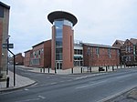
Beverley

Beverley is a market and minster town and a civil parish in the East Riding of Yorkshire, England, of which it is the county town. It is located 27 miles (43 km) south-east of York and 9 miles (14 km) north-west of Hull.The town is known for Beverley Minster, Beverley Westwood, North Bar (a 15th-century gate), St Mary's Church and Beverley Racecourse. It inspired the naming of the city of Beverly, Massachusetts, which in turn was the source of the name for Beverly Hills, California. The town was listed in the 2018 Sunday Times report on Best Places to Live in northern England.The town was originally known as Inderawuda and was founded around 700 AD by Saint John of Beverley during the time of the Anglian kingdom of Northumbria. After a period of Viking control, it passed to the Cerdic dynasty, during which it gained prominence in terms of religious importance in Great Britain. It continued to grow especially under the Normans when its trading industry was first established. A place of pilgrimage throughout the Middle Ages due to its founder, it eventually became a significant wool-trading town. Beverley was once the tenth-largest town in England, as well as one of the richest, because of its wool and the pilgrims who came to venerate its founding saint, John of Beverley. After the Reformation, the stature of Beverley was much reduced. In the 20th century, Beverley was the administrative centre of the local government district of the Borough of Beverley (1974–1996). It is now the county town of the East Riding, located 8 miles (13 km) north-west of Hull, 10 miles (16 km) east of Market Weighton and 12 miles (19 km) west of Hornsea. According to the 2001 United Kingdom census the total population of the urban area of Beverley was 29,110 – of whom 17,549 live within the historic parish boundaries. The population of the parish had risen to 18,624 at the time of the UK's 2011 census.
Excerpt from the Wikipedia article Beverley (License: CC BY-SA 3.0, Authors, Images).Beverley
Corporation Road,
Geographical coordinates (GPS) Address Nearby Places Show on map
Geographical coordinates (GPS)
| Latitude | Longitude |
|---|---|
| N 53.845 ° | E -0.427 ° |
Address
Tesco Carpark
Corporation Road
HU17 9HG
England, United Kingdom
Open on Google Maps


